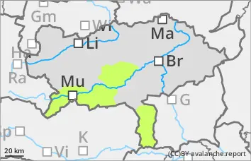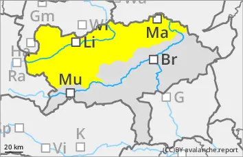
Danger level
 |
|  |  | |||||
|  |
|  |


![]()
Dominant wet snow problem all day long
The avalanche risk is moderate. From the morning onwards, mostly medium-sized, wet loose snow and slab avalanches can release themselves or be triggered by people from terrain that has not yet been discharged in all aspects. In a few extremely steep, shady areas above 2200 m, small to medium-sized slab avalanches can still be triggered in persistent weak layers.
Snowpack
The outgoing longwave radiation at night is weak, so that the snow surface softens in the morning. Due to further soaking during the daytime changes, the isothermal snow cover up to high altitudes increasingly loses firmness. In very shady areas above 2200 metres, the snowpack still has cold reserves and in some cases has prone-to-triggering weak layers such as angular shapes and deep rime in the persistent weak layer. Deep and, in places, middle layers are also snowed out.
Tendency
Monday will continue to be mild, with often strong southerly winds. The wet snow problem will persist.