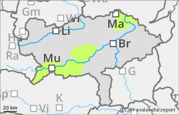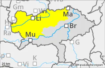
Danger level
 |
|  |  | |||||
|  |
|  |


![]()
Wet snow as the main danger up to high altitudes
The avalanche risk is moderate. From the morning, small to medium-sized, wet loose snow and slab avalanches can release themselves or be triggered by people in all aspects of the terrain that has not yet been discharged. In a few extremely steep, shady areas above 2200 metres, small to medium-sized slab avalanches can still be triggered in persistent weak layers.
Snowpack
The outgoing longwave radiation at night is repeatedly weak, so that the snow surface softens in the morning. The isothermal snow cover up to high altitudes is moist or wet, which leads to decreasing firmness. In very shady areas above 2200 metres, there are still prone to triggering weak layers such as angular shapes and deep rime in the persistent weak layer. Deep and, in places, middle layers are snowed out.
Tendency
With the collapse of the Föhn wind, very changeable April weather with sun, clouds and short showers will set in from Tuesday. The snowfall level will remain above 2000 metres. The wet snow problem remains predominant.