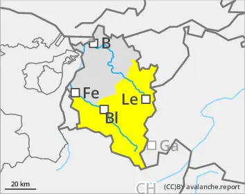
Heightened wet-snow danger from early morning, at high altitudes old snow and small drifts
Danger of wet-snow avalanches is heightened even as of early morning, particularly on very steep north-facing slopes at 1800-2200m. As a result of daytime warming and solar radiation, avalanche danger quickly increases, in all aspects below 2400m, on on very steep sunny slopes up to high altitudes. Naturally triggered avalanches can be expected, avalanches can also be triggered by persons and grow to large size, also sweep along great amounts of wet snow in their plummet path and then extend to very long runout zones. In high alpine regions, small ridgeline snowdrift accumulations are still prone to triggering. In addition, winter sports enthusiasts can in places on high-altitude shady slopes trigger near-surface weak layers. Such danger zones are impossible to recognize. Atop the hardened snowpack surface, there is danger of being forced to take a fall on steep slopes.
Snowpack
Following reduced outgoing radiation and mild temperatures, the snowpack is hardly freezing at night. At altitudes of 1800-2200m the snowpack, even on north-facing slopes, is thoroughly wet and ground-level layers of rotten snow are prone to triggering already in early morning. In high-altitude, steep and shady terrain, there are unfavorable intermediate layers in the uppermost metre of the snowpack which in places are prone to triggering. A thick mid-section of compact layers blankets the deep hoar and faceted crystals at the base of the snowpack.
Tendency
As a result of light foehn conditions and instable air, little change is anticipated.
Danger level
Avalanche Problem
Wet snow
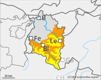
Rainfall will increase danger of wet-snow avalanches
Following the rainfall yesterday and a night of partially cloudy skies, the snowpack can hardly freeze. The danger of wet-snow avalanches is heightened already in early morning and rises further due to daytime warming and solar radiation within the specified danger level over the course of the morning. Naturally triggered avalanches can be expected, most remain medium-sized. On steep, smooth-ground slopes with lots of snow which have not yet discharged, glide-snow avalanches can trigger in all aspects.
Snowpack
Due to reduced nocturnal longwave outgoing radiation and ongoing mild temperatures, the snowpack does not freeze at night. At all altitudes the snowpack is thoroughly wet.
Tendency
As a result of light foehn conditions and instable air, little change is anticipated. The slopes will continue to become bare of snow.
Danger level
Avalanche Problem
Wet snow
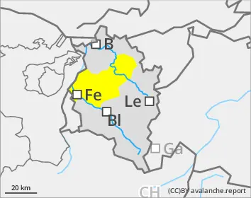
Small wet-snow slides possible
Due to solar radiation, wet loose-snow avalanches can trigger naturally, particularly on extremely steep slopes. Avalanches will be mostly small-sized.
Snowpack
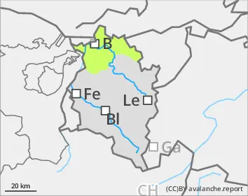
South-facing slopes are frequently bare of snow. Where there’s a snowpack on the ground, it’s thoroughly wet.