Rainfall will increase danger of wet-snow avalanches
Following a night of partly cloudy skies, snow is thoroughly wet already in early morning. Rainfall will heighten the likelihood of wet-snow avalanches triggering during the course of the day. Wherever the rainfall is heavy, wet loose-snow slides can sweep along more snow into the plummet path, turning the releases into large-sized ones with long plummet paths, particularly on north-facing slopes where there is a lot of snow on the ground.On steep, smooth-ground slopes with lots of snow which have not yet discharged, glide-snow avalanches can trigger in all aspects.
Snowpack
Due to reduced nocturnal longwave outgoing radiation and ongoing mild temperatures, the snowpack does not freeze at night. During daytime hours, up to 10mm of rainfall is expected in some places.
Tendency
Due to reduced nocturnal longwave outgoing radiation on Thursday night, wet-snow problem will predominate already in early morning on Friday.
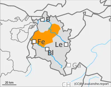
Danger level
2400m
Avalanche Problem
Wet snow
2400m
Persistent weak layer
2400m
At low and intermediate altitudes, wet-snow; at high altitudes, old snow and small drifts.
Following a night of partly cloudy skies, the snowpack hardly freezes below 2400m and is rotten already in the early morning hours. Avalanches can in places be easily triggered, in particular on very steep north-facing slopes at altitudes between 1800 and 2200m. In addition, the likelihood of wet-snow avalanches will increase due to rainfall. Naturally triggered avalanches can be expected; and persons can trigger wet-snow avalanches. Avalanches can sweep along more snow into their plummet path and thereby grow to large size. At high altitudes, small snowdrift accumulations will be generated which - particularly near ridgelines - are prone to triggering. Furthermore, winter sports enthusiasts can trigger avalanches in the near-surface weak layers on high-altitude shady slopes in places. Such danger zones are impossible to recognize. Atop the hardened snowpack surface in high alpine regions, there is danger of being forced to take a fall on steep slopes.
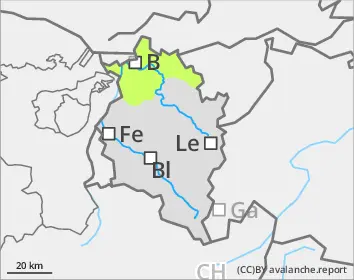
Snowpack
During the course of the day, up to 5cm of fresh snow is anticipated above 2200m, accompanied by wind impact; lower down there will be rainfall. At altitudes between 1800 and 2200m, the snowpack is thoroughly wet, even on north-facing slopes, and the rotten snow at ground level is highly prone to triggering even in the early morning. In high-altitude, steep and shady terain, there are unfavorable intermediate layers in the uppermost metre of the snowpack which in places are prone to triggering. A thick mid-section of compact layers blankets the deep hoar and faceted crystals at the base of the snowpack.
Tendency
After weather conditions improve, the daily danger-cycle will return.
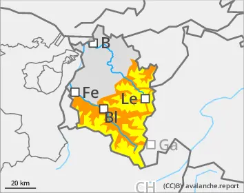
Danger level
Avalanche Problem
Wet snow
Small wet-snow slides as a result of rainfall
Due to rain impact, wet loose-snow avalanches can trigger naturally, particularly in extremely steep terrain. Avalanches are generally small-sized.
Snowpack
South-facing slopes are frequently bare of snow. Where there’s a snowpack on the ground, it’s thoroughly wet.
Tendency
Improving weather conditions. The slopes will continue to become bare of snow.