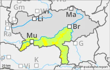
Danger level
 | 1500m |
|  |
|  |

![]()
Snowboards can easily be triggered!
The avalanche danger above 1500 metres is assessed as considerable (level 3). The new fallen snow and the extensive snowdrift accumulations are prone to triggering, especially above the tree line. The main problem is wind slab. The avalanche prone locations are adjacent to ridgelines and far from ridgelines. They are mainly located in gullies, bowls and behind terrain edges. The layer of drifting snow can be triggered by individual winter sports enthusiasts as a medium-sized avalanche. It cannot be ruled out that the slab will travel through to layers close to the ground. Loose snow avalanches are also possible in isolated cases. Defensive behaviour is recommended when ski touring.
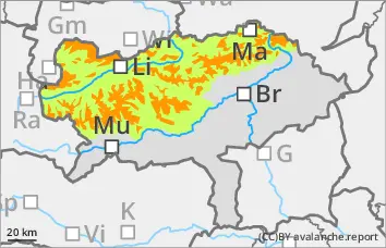
Snowpack
Since the beginning of the precipitation event, 40 to 80 cm of new fallen snow has fallen in the northern part of the reservoir. The snow was transported by the strong to stormy north-westerly wind. Fresh snowdrift accumulations are deposited above the tree line on a partly still weak old snowpack. The snowdrift accumulations should not be underestimated! Weak layers are located in the bound layer or transition to the old snow, at higher altitudes in places still in the persistent weak layer (faceted crystals in the area of crusts) or occasionally in layers close to the ground in the form of floating snow. The persistent weak layer is also partially moist.
Tendency
From Sunday, the weather will again be prone to disturbances. The sky will be mostly cloudy or very cloudy. It will snow repeatedly along the northern side of the Alps, but it will remain mostly dry in the peripheral mountains. The wind slab problem will persist.