Danger level
 |
![]()
Beware of fresh wind slab, watch out for persistent weak layer problems in shady high altitudes.
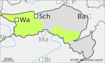
Low avalanche danger
The avalanche risk is still low on Wednesday. Avalanche prone locations are mainly limited to thin pillows of wind drifted snow in extremely steep entrances to shady gullies and bowls. Small slab avalanches can be triggered here in isolated cases.
Snowpack
The snowpack is mostly stable. A well-developed and mostly stable melt-freeze crust is covered by thin pillows of wind drifted snow in some gullies and bowls. Older pillows of wind drifted snow are usually well bonded to the ground.
Tendency
A cold front will bring stormy winds, a drop in temperature and heavy snowfall in places during the night to Thursday. From Wednesday evening to Saturday morning, widespread amounts of new snow in excess of 40 cm are to be expected. At higher altitudes, these will be heavily transported by the stormy winds. The snowfall level will mostly be at low altitudes. The risk of avalanches will increase significantly.