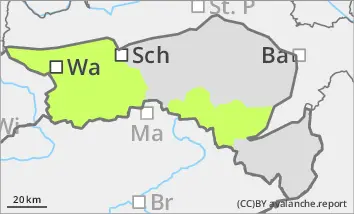
Danger level
 |
![]()
Beware of fresh wind slab, watch out for persistent weak layer problems in shady high altitudes.
Generally low avalanche danger
The avalanche risk is still low. Avalanche prone locations are mainly limited to thin pillows of wind drifted snow in extremely steep entrances to shady gullies and bowls. Small slab avalanches can occasionally be triggered here.
Snowpack
The snowpack is mostly stable. A well-developed and mostly stable melt-freeze crust is covered in places by thin pillows of wind drifted snow. Older pillows of wind drifted snow are usually well bonded to the subsoil.
Tendency
On Wednesday, it will remain quite sunny and dry during the day. The temperature rises significantly and the risk of avalanches remains low. In the night to Thursday, a cold front will bring stormy winds, a drop in temperature and heavy snowfall in places. The snowfall level drops rapidly and is mostly at low altitudes. From Thursday to Sunday, large amounts of new snow are expected in the mountains. The risk of avalanches will therefore increase significantly.