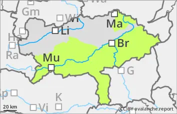
Danger level
 | treeline |
|  |
|  |

![]()
Avalanche danger increases above the tree line with new fallen snow and wind
There is a moderate avalanche risk above the tree line. New fallen snow and sometimes stormy north-westerly winds create fresh snowdrift accumulations. Especially behind broad ridges and ridgelines as well as in gullies and bowls, these can be disturbed in places by individuals and triggered as small to medium-sized slab avalanches. The avalanche prone locations are usually easy to recognise if visibility is good. Apere areas are covered by new fallen snow, making it difficult to recognise the risk of injury.
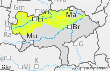
Snowpack
Under the influence of strong winds, 5 - 15 cm of new fallen snow, locally even more, falls on a crusted can form old snowpack. In many places, a built-up transformed surface or surface hoar is covered. The connection between the drift snow layer and the persistent weak layer is poor. On the shady slopes, there are sometimes weak layers of faceted crystals in the old snow foundation. At lower altitudes, the snow often falls on apery ground.
Tendency
It will remain windy and cold on New Year's Eve, with a few centimetres of new fallen snow again along the northern side of the Alps. Watch out for the wind slab problem!