Danger level
 |
|  |  |

![]()
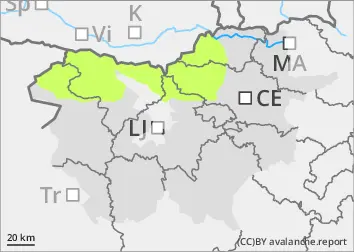
The risk of avalanches remains low.
Snow cover is mostly stable. Creep is unlikely. In arid areas above the forest line, weak layers may be present in the snow cover. In a few places in the high mountains, a small, clustered avalanche may be triggered under higher loads.
Snowpack
dp.4: cold following warm / warm following cold
Snow cover is mostly stable, with significant snowmelt on slopes. Crusting is present on the slopes, while the snow cover remains soft and dry in the more shaded and sheltered areas, especially in the high mountains. In arid areas, weak layers may be present in the snow cover.
Tendency
Wednesday will be cloudy and foggy. Light snow will fall with mainly weaker south to south-westerly winds. The snow limit will be between 1800 m and 2000 m above sea level. In the high mountains, no more than 10 cm of new snow will fall. The new snow will not change the avalanche risk. On Thursday, the mountains will be fairly clear, with temperatures still quite high for this time of year.