Danger level
 |
|  |  |

![]()
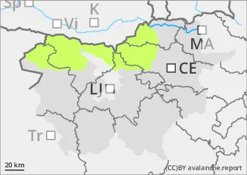
The risk of avalanches remains low.
Snow cover is mostly stable. In arid areas above the forest line, weak layers may be present in the snow cover. In a few places in the high mountains, a small, clustered avalanche may be triggered under higher loads. Some creeping of dry, untracked new snow is possible.
Snowpack
dp.4: cold following warm / warm following cold
Snow cover is mostly stable, with significant snowmelt on slopes. In the osoles, weak layers may be present in the old snow cover. Light to moderate south-westerly winds will produce light snow during the day. The snow limit will be around 1800 m above sea level. Up to 10 cm of new snow will fall in the high mountains, with wind building new small drifts.
Tendency
Thursday will be cloudy and foggy in the mid mountains, with a chance of clearer weather in the high mountains above 2000 m. There will be light to moderate westerly winds. On Friday, there will be more clarity in the mountains and the wind will weaken.