Increasing daytime danger of avalanches due to rising temperatures and solar radiation
Early until late morning: following a night of clear skies, favorable conditions widespread. Acute danger of falls on the hardened snowpack surface. Daytime hours: due to rising temperatures and solar radiation, likelihood of wet loose-snow avalanches will increase significantly esp. along the Italian border. Isolated naturally triggered avalanches are possible due to the thoroughly wet snowpack. Wet-snow avalanches can often fracture down to ground level. Wet-snow avalanches can reach medium size, esp. on extremely steep sunny slopes in high altitude starting zones. The runout zones should be avoided. Weak layers in the old snow above 2300m can trigger in isolated cases, esp. by large additional loading. These danger zones occur on steep slopes on W/N/E-facing slopes. Dry-snow avalanches can in isolated cases reach medium size.
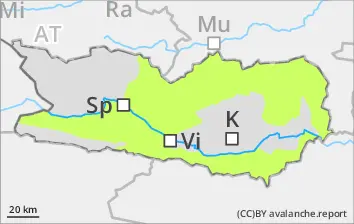
Snowpack
Nocturnal outgoing longwave radiation will be quite good. The snowpack surface will freeze and be capable of bearing loads in early morning, softening subsequently over the course of the day. The lowermost layers of the snowpack are moist, particularly on sunny slopes at all altitudes and on shady slopes below 2200m. Inside the old snowpack on N/W/E-facing slopes there are faceted, expansively metamorphosed weak layers, esp. abov 2200m. Below 1600m there is hardly any snow on the ground.
Tendency
Little change expected
BEFORE NOON Danger level
AFTERNOON Danger level
Avalanche Problem
Wet snow
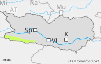
Isolated danger zones at high altitudes
Early until late morning: following a night of clear skies, favorable conditions widespread. Acute danger of falls on the hardened snowpack surface. Daytime hours: due to rising temperatures and solar radiation, likelihood of wet loose-snow avalanches will increase significantly esp. along the Italian border. Isolated naturally triggered avalanches are possible due to the thoroughly wet snowpack. Wet-snow avalanches can often fracture down to ground level. Wet-snow avalanches can reach medium size, esp. on extremely steep sunny slopes in high altitude starting zones. The runout zones should be avoided. Weak layers in the old snow above 2300m can trigger in isolated cases, esp. by large additional loading. These danger zones occur on steep slopes on W/N/E-facing slopes. Dry-snow avalanches can in isolated cases reach medium size.
Snowpack
Nocturnal outgoing longwave radiation will be quite good. The snowpack surface will freeze and be capable of bearing loads in early morning, softening subsequently over the course of the day. The lowermost layers of the snowpack are moist, particularly on sunny slopes at all altitudes and on shady slopes below 2200m. Inside the old snowpack on N/W/E-facing slopes there are faceted, expansively metamorphosed weak layers, esp. abov 2400m. Below 1800m there is hardly any snow on the ground.
Tendency
Little change expected
BEFORE NOON Danger level
AFTERNOON Danger level
Avalanche Problem
Wet snow
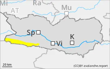
Likelihood of wet-snow slides will rise during daytime hours
Due to daytime warming and solar radiation, likelihood of wet snow slides will increase during the course of the day. Runout zones should be avoided. Some starting zones have already completely discharged. On hardened surfaces, acute danger of falls, esp. in the morning hours.
Snowpack
Nocturnal outgoing longwave radiation will be quite good. The snowpack surface will freeze and be capable of bearing loads in early morning, softening subsequently over the course of the day. As of midday, sunshine and warmth will make the snowpack increasingly wet. Below 1600m there is hardly any snow on the ground.