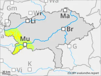
Avalanche danger above 1.800 m moderate and below 1.800 m low. The main problem is fresh snowdrift. Danger spots are located in the north sector above 1.800 m. Small slab avalanches can be triggered by an alpinist in extremely steep slopes. Caution behind ridgelines.
Snowpack
In the last 24 hours it had 15 to 30 cm new snow. The southern winds drifted the new snow to the northern sector. The peak of precipitation was between Turrach heights and Niedere Tauern. In high altitudes the fresh snowdrift is placed on top of a hard old snow cover or on top of faceted snow. In medium altitudes the snow is on top of meadows.
Tendency
No significant change of the avalanche danger is to expect.
Danger level
Avalanche Problem
Wet snow
Wind slab
2200m
Snowdrift. Caution in the northern sector!
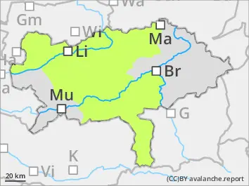
Avalanche danger is in general low. In high altitudes fresh snowdrift deposits are formed in the northern expositions. These can be triggered by an alpinist.
Snowpack
In the last 48 hours up to 30 cm of new snow has landed. The highest amounts of new snow are in the area of Niedere Tauern. The new snow covers the stable snow base. The southern winds drifted the new snow to the northern sector. The fresh snowdrift is placed on top of a hard snow cover or on top of faceted snow.
Tendency
No significant change of the avalanche danger is to expect. Weather for Sunday: predominantly cloudy. It can clear up a little bit in the area of Niedere Tauern but elsewhere it will stay cloudy. The higher summits are foggy and the visibility is poor. High amounts of new snow are not to expect.