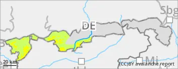
Avalanche danger above the timberline is moderate, below that altitude danger is low. Snowdrifts are the main problem. Small (in isolated cases medium-sized) slab avalanches can be triggered by minimum additional loading. Avalanche prone locations are found in steep N/E-facing ridgeline terrain as well as in wind-loaded gullies and bowls. Frequency and size increase with ascending altitude. On very steep slopes with sufficient snow over smooth ground small glide-snow avalanches cannot be excluded, in particular in the Allgäu.
Snowpack
0-15cm of new snow -- in orographic barrier zones in the Allgäu even a bit more -- will fall by Wednesday evening accompanied mainly by westerly winds. Small-scale snowdrifts will accumulate in leeward terrain. At intermediate altitudes the snowdrifts will either be deposited on bare ground or on a moist old snowpack surface with which it can bond well. With ascending altitude the bonding will become poorer, especially on shady side slopes above approx. 2000m. Layers that are prone to triggering can also form in the snowdrifts. The old snowpack, in contrast, is mostly stable; at intermediate altitudes moist down to low laying layers. Below 2400m the snowpack base is often wet.
Tendency
Weather conditions remain unstable. No significant change of avalanche danger anticipated.
Danger level
treeline
Avalanche Problem
Wind slab
Treeline
Only few avalanche prone locations in limited-scope snowdrifts.
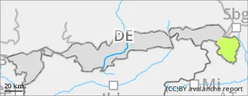
Avalanche danger is low. Snowdrifts are the main problem. Small slab avalanches can sporadically be triggered even by minimum additional loading. Avalanche prone locations are found in steep N/E-facing ridgeline terrain as well as in wind-loaded gullies and bowls. On very steep slopes with sufficient snow over smooth ground small glide-snow avalanches cannot be excluded.
Snowpack
Some 10cm of new snow will fall by Wednesday evening, accompanied mainly by westerly winds. Small-scale snowdrifts will accumulate in leeward terrain. The snowdrifts will either be deposited on bare ground or on a moist old snowpack surface with which they can bond well. Layers that are prone to triggering can form in the snowdrifts in some places. The old snowpack is thoroughly moist and wet down to the ground.
Tendency
Weather conditions remain unstable. No significant change of avalanche danger anticipated.
BEFORE NOON Danger level
treeline
Avalanche Problem
Wind slab
Treeline
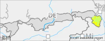
AFTERNOON Danger level
treeline
Avalanche Problem
Wind slab
Treeline
Caution: small-scale snowdrifts.
Avalanche danger is low in the morning, but rises to moderate above the timberline during the course of the day. Snowdrifts are the main problem. Slab avalanches that are mostly small can be triggered by minimum additional loading. Avalanche prone locations are found in steep N/E-facing ridgeline terrain as well as in wind-loaded gullies and bowls. Frequency and size increase with ascending altitude and during the course of the day. On very steep slopes with sufficient snow over smooth ground small glide-snow avalanches cannot be excluded.
Snowpack
10cm to 15cm of new snow will fall on Wednesday, accompanied mainly by westerly winds. Shallow snowdrift accumulations will be generated in leeward areas which will grow a bit as the day progresses. At intermediate altitudes the snowdrifts will either be deposited on bare ground or on a moist old snowpack surface with which it can bond well. With ascending altitude the bonding will become poorer, especially on shady side slopes above approx. 2000m. Layers that are prone to triggering can also form in the snowdrifts. The old snowpack as such is stable; at intermediate altitudes moist down to low laying layers. Below 2400m the snowpack base is frequently wet.
Tendency
Weather conditions remain unstable. No significant change of avalanche danger anticipated.