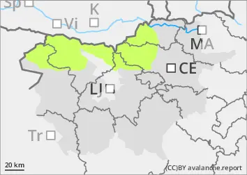
Danger level
 |
|  |  | |||||
| |  |


![]()
There will be low danger of avalanches
The old snow cover is mostly well transformed, cohesive and stable. The danger of wet snow avalanches will be relatively low. As the weather warms up, some Avalanches may occur during the day. A small amount of new snow has fallen in recent days, particularly in the high alpine regions. Smaller snow accumulations have formed and may be potentially unstable.
Snowpack
dp.10: springtime scenario
When the weather clears, the snowpack will mostly freeze overnight. During the day, the snow will become heavier again. The zero isotherm will rise above 3000 m above altitudes during the day. Between 5 and 10 cm of new fallen snow has fallen this week above about 2000 m. Precipitation has been patchy with showers. Even in the high alpine regions, showers have been quite heavy.
Tendency
At the weekend it will be quite clear and relatively warm during the day. The snowpack will be mainly hard and frosty in the morning. It will become heavier during the day. Avalanches of packed snow will be possible, especially in high alpine regions where there is still some unprocessed snow.