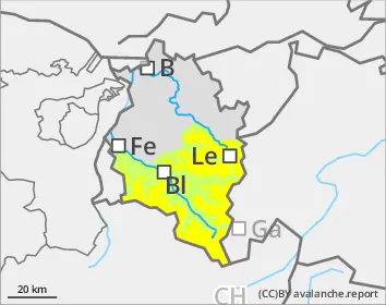
Naturally triggered avalanches expected during course of day
Rising wet-snow avalanche danger during course of day
During the course of the day, danger of wet-snow avalanches will increase. Isolated wet slab avalanches can be triggered by winter sports enthusiasts. After the melt-freeze crust (capable of bearing loads) softens up, also naturally triggered wet-snow avalanches are possible. Caution urged particularly towards steep shady slopes at 2200-2500m which have not yet discharged and slopes in all aspects where there is area-wide snow on the ground. Avalanches can fracture in weak old snowpack layers, in isolated cases grow to large size and lay back huge runout zones, quite atypically. On steep slopes with lots of snow on the ground which have not yet discharged with smooth underground, such as grass-covered slopes or rock plates, glide-snow avalanches can release in all aspects. In addition, winter sports enthusiasts can trigger isolated avalanches in near-surface weak layers on high-altitude shady slopes. Such danger zones are nearly impossible to recognize.
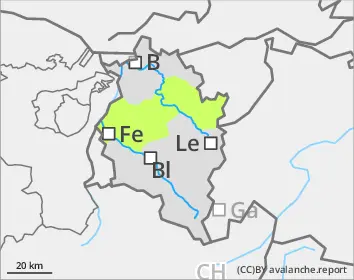
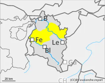
Snowpack
During the night, a melt-freeze crust will form which is capable of bearing loads, then soften up during the daytime. At altitudes of 1800-2500m the ground-level layer of rotten snow is thoroughly wet even on north-facing slopes and is prone to triggering. On shady, steep high-altitude slopes there are unfavorable intermediate layers in the uppermost metre of the snowpack which can be triggering in some places. A deep mid-level section of compact layers blankets a fundament of buried hoar and faceted crystals.
Tendency
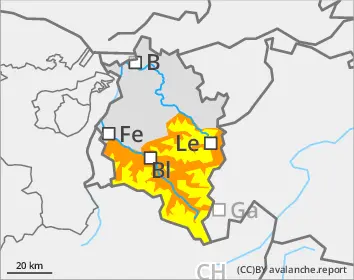
Nocturnal outgoing longwave radiation will be limited. During the daytime on Sunday, temperatures will gradually drop, shower activity increase. The snowfall level will descend from 2200 down to 1800m. Danger of wet-snow avalanches will continue.
EARLIER Danger level
Avalanche Problem
Wet snow
LATER Danger level
Avalanche Problem
Wet snow
Wet-snow danger in very steep terrain where there is still lots of snow
During the course of the day, danger of wet-snow avalanches will increase to moderate. Isolated wet slab avalanches can be triggered by winter sports enthusiasts. Avalanche prone locations occur generally only in summit zones. Avalanches will generally be medium-sized. On steep slopes where there is still lots of snow on smooth ground, glide-snow avalanches can trigger in all aspects.
Snowpack
During the night, a melt-freeze crust will form which is capable of bearing loads, then soften up during the daytime. The snowpack is thoroughly wet up to summit zones in all aspects. Low altitude zones are bare of snow. On sunny slopes the ground is becoming bare of snow up to high altitudes.
Tendency
Nocturnal outgoing longwave radiation will be limited. During the daytime on Sunday, temperatures will gradually drop, shower activity increase. The snowfall level will descend from 2200 down to 1800m. Danger of wet-snow avalanches will continue.
Danger level
Avalanche Problem
Wet snow
Small wet-snow slides possible
On extremely steep slopes, persons can in isolated cases trigger wet loose-snow slides where there is still sufficient snow on the ground.
Snowpack
Lower altitude zones are bare of snow. On sunny slopes the ground is becoming bare of snow. Where there is a snowpack, it is thoroughly wet. During the night, a crust forms which is capable of bearing loads, then softens up during daytime hours.
Tendency
Nocturnal outgoing longwave radiation will be limited. During the daytime on Sunday, temperatures will gradually drop, shower activity increase. The snowfall level will descend from 2200 down to 1800m. Danger of wet-snow avalanches will continue.