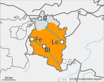
Starting in early morning: considerable avalanche danger
The snowpack is weak up to high altitudes, partly due to lack of nocturnal shortwave outgoing radiation, partly due to rainfall and mild temperatures. In very steep terrain in all aspects, wet slides and avalanches can be expected. These releases can grow to large size. On steep snow-covered grassy slopes, glide-snow avalanches are possible. Caution below glide cracks in the surface of the snowpack. In addition, medium-sized avalanches can be triggered in older snowdrifts, as well as on high-altitude shady slopes in the weak old snow, by winter sports enthusiasts.
Snowpack
The old snowpack us weak up to over 2000m already in the early morning hours. During the daytime, mild temperatures and solar radiation make the snowpack wetter, rapidly leading to a further loss of firmness. Above the timberline, older snowdrift accumulations are frequently prone to triggering. On steep, shady high-altitude slopes, the old snowpack often has unfavorable intermediate layers and a poorly-structured fundament.
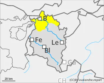
Tendency
Daytime rise in avalanche danger
Danger level
Avalanche Problem
Wet snow
Main danger: wet-snow avalanches
The snowpack is weak, partly due to lack of nocturnal shortwave outgoing radiation, partly due to rainfall and mild temperatures. In very steep terrain in all aspects, wet slides and avalanches can be expected. On steep snow-covered grassy slopes, glide-snow avalanches are possible. Caution below glide cracks in the surface of the snowpack.
Snowpack
The old snowpack is weak up to over 2000m already in the early morning. During the daytime, mild temperatures and solar radiation lead to the snowpack becoming still wetter and rapidly forfeiting its firmness.