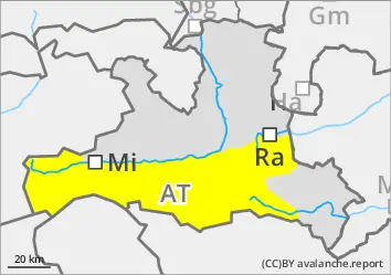
The avalanche danger increases from moderate to considerable during the daytime changes below 2500 metres.
Spontaneous avalanche activity increases rapidly as the day warms up and the sun shines. Medium and occasionally also large damp and wet loose snow avalanches and snow slabs are to be expected in all aspects below around 2500 metres. Tours in terrain that has not yet been discharged should be ended in good time. Wet avalanches can also be triggered by winter sports enthusiasts.
Gliding avalanches are to be expected on typical slopes.
In a few places above 2000 m, snow slabs in the persistent weak layer or last week's wind slab can also be triggered, especially on west-, north- and east-facing slopes, as well as south-facing slopes in the high Alps. Avalanche prone locations are difficult to recognise.
Snowpack
In the morning, at low altitudes, there is often a (crumbly) melt-freeze crust on top of this week's new and wind slab snow, which softens quickly. In higher, wind-calm places, there is an average of half a metre of settled new and drift snow, while exposed places are heavily blown and snowdrift accumulations are correspondingly thick. A thin melt-freeze crust from last weekend remains underneath. There are angular shapes and deep rime in the old snowpack on shady slopes. Fractures are most likely to occur within the no longer quite fresh snowdrift accumulations, increasingly also on the uppermost crust, and only rarely in the floating snow close to the ground. Up to high altitudes, longer sunny slopes become moist to wet down to the ground, and the north-facing snow is also moistened on the surface.
Tendency
Little change with a weak cold front on Monday.
EARLIER Danger level
2000m
Avalanche Problem
Persistent weak layer
2000m
Wet snow
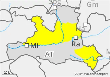
LATER Danger level
Avalanche Problem
Wet snow
Persistent weak layer
2000m
End tours on time!
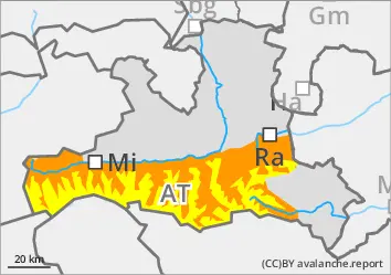
The avalanche risk is moderate.
Spontaneous avalanche activity increases rapidly as the day warms up and the sun shines. Small and medium-sized wet loose snow avalanches and snow slabs can be expected in all aspects. Tours in terrain that has not yet been unloaded should be ended in good time. Wet avalanches can also be triggered by winter sports enthusiasts.
Gliding avalanches are to be expected on typical slopes.
In a few places above 2000 metres, snow slabs in the extended northern sector in weak weak layers or the wind slab of the last week can also be triggered.
Snowpack
In the morning, you often find a (brittle) melt-freeze crust on this week's new and wind-slabbed snow, which softens quickly. Underneath is a thin melt-freeze crust from last weekend. There are angular shapes and deep rime in the old snowpack on shady slopes. Breaks are most likely to occur within the no longer quite fresh snowdrift accumulations, increasingly also on the uppermost crust, and only rarely in the floating snow close to the ground. Up to high altitudes, longer sunny slopes become moist to wet down to the ground, and the north-facing snow is also moistened on the surface.
Tendency
Little change with a weak cold front on Monday.
EARLIER Danger level
Avalanche Problem
Wet snow
LATER Danger level
Avalanche Problem
Wet snow
End tours on time!
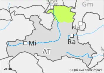
The avalanche risk is low.
With the warming and the sunshine, small, wet loose snow avalanches are to be expected. Gliding avalanches may also occur occasionally.
Snowpack
The snowpack is damp to wet and has a (brittle) melt-freeze crust in the morning. The snow cover is rapidly thinning out.