Danger level
 | 1400m |
|  |
|  |

![]()
Beware of fresh wind slab, watch out for persistent weak layer problems in shady high altitudes.
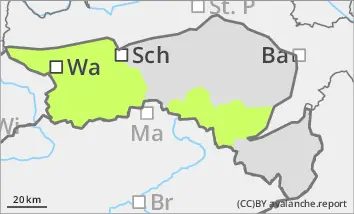
The avalanche risk is still low. Avalanche prone locations are mainly limited to fresh snowdrift accumulations in gullies and bowls as well as in steep terrain adjacent to ridgelines. These are small in scale and irregularly distributed due to the changing wind. They can be triggered as small slab avalanches by individual winter sports enthusiasts. In addition, the persistent weak layer problem must still be taken into account in shady high altitudes. Weak layers in the lower snow layering can be prone to triggering locally.
Snowpack
The snowpack is mostly stable. A melt-freeze crust in the snowpack is overlaid by graupel in places. In combination with fresh new fallen snow transported by wind from different directions, weak layers and areas prone to triggering on a small scale are developing locally. In shady high altitudes, large, faceted crystals are still present in the persistent weak layer in places, weakening the foundation of the snowpack. Below around 1400 metres, and on south-facing slopes below around 1600 metres, there is only a little snow.
Tendency
Thursday will be mainly sunny, but from Friday onwards dense clouds will play a greater role in the weather again. Individual snow or sleet showers cannot be ruled out. The avalanche risk remains the same.