Danger level
 |
![]()
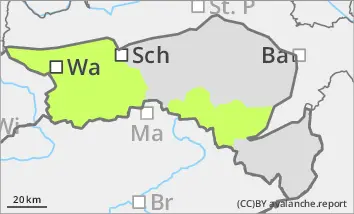
Avalanche danger remains low. Wet snow slides are possible on steep slopes during the day, which can also be triggered by individual winter sports enthusiasts. Caution is still advised on shady slopes, where small slab avalanches are possible in persistent weak layers.
Snowpack
The cloudless nights of the last few days have allowed a melt-freeze crust to form, which softens again during the day with rising temperatures and sunlight. This melt-freeze crust lasts longer in shady locations. Convective showers have deposited graupel in places, which can still remain in shady high altitudes. In gullies and bowls, the wind slab is well stabilised, but in narrow places it is icy in places. Faceted crystals are partially weakening the snow base, fundament at higher elevations in the northern sector. As temperatures remain mild, the snow is melting. The snowpack is becoming increasingly moist and thinner, especially in sunny areas. Below around 1400 metres, and below around 1600 metres on sunny slopes, there is only a little snow.
Tendency
The avalanche danger remains low for the time being. A cold front will move through from the north-west on Monday, bringing snow showers and cooling.