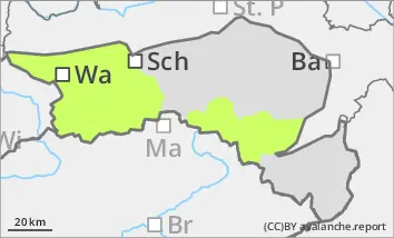
Danger level
 |
![]()
Low avalanche danger
The avalanche danger remains low. Nevertheless, isolated wet snow slides are possible on steep slopes, which can also be triggered by individual winter sports enthusiasts. On shady slopes, small slab avalanches are still possible in persistent weak layers.
Snowpack
The cloudless nights of the last two days have allowed a melt-freeze crust to form, which softens again during the day as temperatures rise and the sun shines. This melt-freeze crust lasts longer in shady locations. Convective showers have deposited graupel in places, which can still persist in shady high-altitude areas. In gullies and bowls, the wind slab is well stabilised, but in some narrow places it is icy. Faceted crystals are partially weakening the snow base, fundament at higher elevations in the northern sector. There is only a little snow below 1400 metres and below 1600 metres on sunny slopes.
Tendency
The avalanche danger remains low. Saturday will be foehn and quite sunny. However, the south wind will be strong to stormy at higher altitudes. More clouds will gather on Sunday and it will start to cool down. The coming week will then bring changeable and much cooler weather.