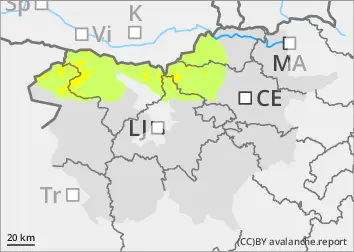
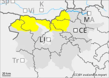
As the weather warms up, the danger of wet snow avalanches has increased.
The main danger will be wet snow avalanches and gliding avalanches. As the weather warms up during the day, the danger of triggering will increase, especially on sunny slopes.
However, there are still a few places in the high alpine regions with blown snow where avalanches can be triggered in particular if the load is too high. Weak layers in the snowpack are also a problem. If the load exceeds the load-bearing capacity of the deeper Weak layers, a deep and large avalanche can be triggered. There are many such weak layers, especially on axis above the forest.
Snowpack
dp.1: deep persistent weak layer dp.10: springtime scenario
The snowpack freezes at night, but during the day it becomes hard and unstable on Sunny slopes. In the mid-mountains, the snowpack also melts. In the more arid parts, the snowpack does not change much due to the dry air mass.
The old snow cover is made up of layers of bonded snow that are already somewhat compacted and are mostly well connected. In the old snow cover, several weak layers of shreds and frosted grains occur deep below the surface.
Tendency
Monday will see more clouds, with occasional fog on the tops. Light local showers, partly showers, will be possible. It will cool down a little and the danger of Avalanches will gradually decrease.