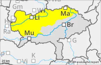
Persistent weak layer problem in shady high altitudes!
The risk of avalanches increases slightly with the warming and sunshine. However, the clouds are dampening the daytime changes. Wet loose snow avalanches from slopes that have not yet discharged are still possible, although there have already been many discharges in the last few days. Triggering of dry slab avalanches is possible in very steep gullies and bowls on shady slopes with high additional loads. The avalanches can tear through to the ground in the northern sector. Occasional gliding avalanches can still slide from grass mats.
Snowpack
During the night, the firmness of the snowpack surface increases again briefly. Due to the mild temperatures and solar radiation, the snowpack loses firmness in the morning. On the northern slopes, the kinetic metamorphism (cup crystals in the snow layer close to the ground!) continues to weaken the snowpack.
Tendency
Monday will still be cloudy and unsettled, with unproductive showers possible, especially in the afternoon. From Tuesday, from today's perspective, high-pressure conditions will prevail again, resulting in calm, windless and mild weather. No significant change in the avalanche risk is expected.
Danger level
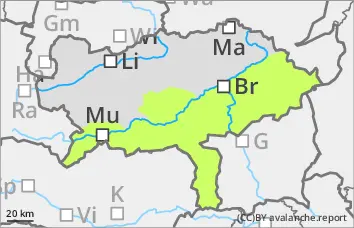
The distortion is progressing!
The avalanche risk is low. Wet loose snow avalanches cannot be ruled out in isolated cases on extremely steep terrain. In the Gurk and Seetal Alps, the triggering of a snow avalanche in the northern sector on extremely steep slopes cannot be ruled out.
Snowpack
Depending on the aspect, the snow becomes damp or wet during the day changes up to high altitudes, which leads to a decreasing firmness and destabilisation of the snowpack. The erosion is progressing! In the northern sector, there is still a persistent weak layer problem in the Gruk and Seetal Alps above 1900 metres.
Tendency
However, rain showers may occur in places on Monday, most likely in the afternoon. Snow showers will only occur above 1500 metres. The wind will hardly be noticeable. At an altitude of 1500 metres, it will be 1 to 5 degrees from east to west at midday. No change in the avalanche danger is expected.