Persistent weak layer problem in shady high altitudes!
The avalanche risk is subject to daytime changes. Conditions are still favourable in the morning. As the weather warms up and the sun shines, the avalanche risk increases considerably. Wet loose snow avalanches can still occur spontaneously in isolated cases. In addition, the triggering of wet slab avalanches is possible in some places, which can reach medium size. Triggering of dry slab avalanches is possible in very steep gullies and bowls on the shady slopes with low additional load. The avalanches can tear through to the ground in the northern sector. Occasional gliding avalanches can still slide from grass mats.
Snowpack
During the night, the firmness of the snow cover surface increases briefly. Due to the mild temperatures and solar radiation, the snowpack quickly loses firmness. On the northern slopes, the kinetic metamorphism (cup crystals in the snow layer close to the ground!) continues to weaken the snowpack.
Tendency
A weakly weather-effective disturbance zone will touch the Styrian mountains on Sunday. The passage will be largely dry, with only some regional snowfall above 1600 metres and rain below. From Monday, high pressure will prevail again with mostly sunny conditions. A slight decrease in the risk of avalanches is expected.
EARLIER Danger level
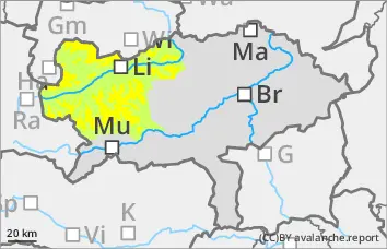
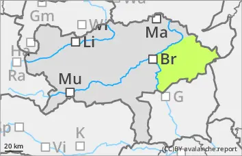
1800m
Avalanche Problem
Persistent weak layer
1800m
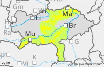
LATER Danger level
1800m
Avalanche Problem
Persistent weak layer
1800m
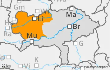
Wet snow
Wet, naturally triggered avalanches are still possible from slopes that have not yet been discharged.
After a mild night, the avalanche danger will increase to moderate (level 2) during the day, especially on slopes with southern aspects. Wet loose snow avalanches may still occur spontaneously in isolated cases. In addition, triggering of wet slab avalanches is possible in some places, which can reach medium size. Triggering of dry slab avalanches is possible in very steep gullies and bowls on shady slopes with low additional load. The avalanches can tear through to the ground in the northern sector. Occasional gliding avalanches can still slide from grass mats.
Snowpack
During the night, the firmness of the snowpack increases slightly. Due to the mild temperatures and solar radiation, the snowpack quickly loses firmness. On the northern slopes, the kinetic metamorphism (cup crystals in the snow layer close to the ground!) continues to weaken the snowpack.
Tendency
A weakly weather-effective disturbance zone will touch the Styrian mountains on Sunday. The passage will be largely dry, with only some regional snowfall above 1600 metres and rain below. From Monday, high pressure will prevail again with predominantly sunny conditions. A slight decrease in the risk of avalanches is expected.
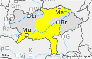
Danger level
The distortion is progressing!
The avalanche risk is low. Occasional wet loose snow avalanches cannot be ruled out in extremely steep terrain.
Snowpack
Depending on the aspect, the snow becomes damp or wet during the day changes up to high altitudes, which leads to a decreasing firmness and destabilisation of the snowpack. The erosion is progressing!
Tendency
A weakly weather-effective disturbance zone will touch the Styrian mountains on Sunday. The passage will be largely dry, with only some regional snowfall above 1600 metres and rain below. From Monday, high pressure will prevail again with predominantly sunny conditions. No change in the avalanche risk is expected.