The current snowpack pattern is uncommon and requires special attention and caution!
New fallen snow has hidden old traps.
Even a small additional load can trigger a medium-sized avalanche near ridges and other typical leeward locations with blowing snow. Chain avalanches are also possible, where the triggering of a small clast of freshly blown snow causes the collapse of old Weak layers in the snowpack!
In some places, the additional load (blowing snow) will naturally trigger cluster avalanches.
Snowpack
dp.1: deep persistent weak layer dp.5: snowfall after a long period of cold
Up to 50 cm of snow fell over the weekend on a thin, old snow base, which was covered with a crust and cut in many places. The new fallen snow covered the old snowpack and did not bond well with it. The snow was blowing in a south to south-easterly wind. New snowdrift accumulations have formed, which naturally put additional stress on the old snow cover, which has deep, persistent weak layers. On Monday, the new fallen snow has become heavier, especially in the mid-mountains, and will freeze overnight.
Tendency
On Thursday, it will snow at first, with a chance of 20 to 30 cm of drier snow. The danger of avalanches will remain high.
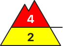
Danger level
2000m
Avalanche Problem
Wind slab
2000m
Persistent weak layer
2000m
Wind slab
2000m
Beware: fresh, trigger-sensitive snowdrifts
Particularly in higher-altitude ridgeline and pass zones, as well as behind drops in the terrain, fresh snowdrift accumulations are extremely prone to triggering. One single winter sports enthusiast can trigger slab avalanches. Releases in the old snow are especially possible by large additional loading. If releases sweep away the entire snowpack, avalanches can grow to medium size. Danger zones occur particularly on steep shady slopes, but also in wind-loaded gullies and bowls in all aspects. Whumpf noises and fractures in the surface are alarm signals. Activities in backcountry demand careful evaluation of the terrain and the dangers.
Snowpack
The latest bout of fresh snow was intermittently transported by strong-velocity winds. Particularly in ridgeline and pass zones, freshly generated small-to-medium sized snowdrift accumulations occur. Especially where they are desposited on top of surface hoar or loose old snowpack layers, the bonding is poor. Small naturally triggered releases and fractures observed by others confirm the snowpack’s proneness to triggering. The old snowpack is overall unfavorably structured. Especially on steep shady slopes the weak intermediate layers and weak fundament have persisted.
Tendency
Fresh snowfall and fresh snowdrifts will lead to slightly increased danger levels within the same Danger Level. The old snowpack continues to be weak.
Danger level
treeline
Avalanche Problem
Persistent weak layer
Treeline
New snow
Treeline
Wind slab
Treeline
Gliding snow
1700m
The current snowpack pattern is uncommon and requires special attention and caution!
New fallen snow has hidden old traps.
Even a small additional load can trigger a medium-sized avalanche near ridges and other typical leeward locations with blowing snow. Chain avalanches are also possible, where the triggering of a small clast of freshly blown snow causes the collapse of old Weak layers in the snowpack!
In some places, the additional load (blowing snow) will naturally trigger cluster avalanches.
Snowpack
dp.1: deep persistent weak layer dp.5: snowfall after a long period of cold
Up to 50 cm of snow fell over the weekend on a thin, old snow base, which was covered with a crust and cut in many places. The new fallen snow covered the old snowpack and did not bond well with it. The snow was blowing in a south to south-easterly wind. New snowdrift accumulations have formed, which naturally put additional stress on the old snow cover, which has deep, persistent weak layers. On Monday, the new fallen snow has become heavier, especially in the mid-mountains, and will freeze overnight.
Tendency
The south-westerly wind will strengthen considerably on Tuesday afternoon and will be able to tolerate light snow! Showers will start to appear on Wednesday night. On Wednesday, we can expect heavier showers with wind! The snowfall level will be around 1300 m above altitudes. The danger of avalanches will increase rapidly during the day on Wednesday.
Danger level
2000m
Avalanche Problem
Wind slab
2000m
Persistent weak layer
2000m
Prone to triggering on weak old snowpack
The avalanche risk is considerable above 2000 m and low below. Slab avalanches can be triggered above 2000 m in some places by low additional loads and can reach medium size. Both fresh and older drift snowpacks as well as the weakly built-up old snowpack can be disturbed; fractures can also tear through into deeper weak layers. The avalanche prone locations generally increase rapidly from the tree line upwards. Drift snow areas and the transition from little to more snow should be consistently avoided. Whumpfing collapsing sounds when stepping on the snowpack can indicate danger.
Snowpack
On a locally very varied snow surface, there is partly soft new fallen snow, which is overlaid by fresh, prone to triggering drift snow packs during the daytime changes. In general, there are often areas with little snow next to considerable snowdrift accumulations. The older snowdrift accumulations have been transformed in places to build up and are soft, in places hard as a board. The old snowpack consists of crusts with faceted crystals in between and deep rime. A break usually occurs around the uppermost crust. The total snow depth is well below average.
Tendency
On Thursday, the foehn subsides, prone to triggering wind slabs are covered by fresh new fallen snow and are difficult to recognise.
Danger level
1800m
Avalanche Problem
Wind slab
1800m
Persistent weak layer
Carefully assess wind slab with increasing height.
The avalanche risk is moderate above 1800 metres and low below that. The main problem is wind slab avalanches. Slab avalanches can be triggered by small additional loads in steep terrain adjacent to ridgelines in the north-west to north to east aspect as well as in gullies and bowls. Avalanches can reach medium size in the Allgäu and when deeper weak layers in the persistent weak layer are disturbed.
Snowpack
On a small scale, windslab snow lies partly on soft snow at high altitudes, otherwise on variously crusted can form snow surfaces. A weak layer of angular snow crystals has formed underneath these layers of harsh snow. In the middle layers, this layer slowly stabilises with mild temperatures and a lack of outgoing longwave radiation. The base of the snowpack often consists of gritty floating snow. There is little to no snow on the south side.
Tendency
Slight increase in avalanche danger with new fallen snow and wind.
Danger level
2000m
Avalanche Problem
Persistent weak layer
2000m
Wind slab
2000m
Prone to triggering wind slab on weak old snowpack. Many stones.
The avalanche risk is moderate above 2000 metres and low below. Slab avalanches can be triggered in a few places by low additional loads and can reach medium size if they tear through the old snowpack. Both fresh and older drift snowpacks as well as the weakly built-up old snowpack can be disturbed; fractures can also tear through into deeper weak layers. The avalanche prone locations increase rapidly from the tree line upwards. Drift snow areas and the transition from little to more snow should be consistently avoided. Whumpfing collapsing sounds when stepping on the snowpack can indicate danger.
Snowpack
On a locally very varied snow surface, there is partly soft new fallen snow, which is overlaid by fresh snowdrift accumulations in the daytime changes in the aspects from west to north to east. In general, there are often areas with little snow next to considerable snowdrift accumulations. The older snowdrift accumulations have been transformed in places to build up and are soft, in places hard as a board. The old snowpack consists of crusts with faceted crystals in between and deep rime. A break usually occurs around the uppermost crust. The total snow depth is well below average.
Tendency
On Thursday, the foehn subsides, the prone-to-triggering wind slab is covered by fresh new fallen snow and is difficult to recognise.
Danger level
1800m
Avalanche Problem
Persistent weak layer
1800m
Wind slab
Treeline
Persistent weak layer problem and some wind slab!
The avalanche risk is still rated as moderate above 1,800 metres and low below that. Older snowdrift accumulations can be triggered as slab avalanches in a few places even with little additional load and can also reach medium size when breaking through into the persistent weak layer. The danger areas are located in the north to east aspects behind ridgelines and terrain edges as well as in the entrance areas to steep gullies and bowls.
Snowpack
Sun and slight warming lead to a settlement of the snowpack. On the northern sides, a layer of snow covers surface hoar and older wind slab in the higher elevations. In the northern and eastern exposures, the snowpack is still weakened with faceted crystals and floating snow (persistent weak layer problem!).
Tendency
An Adriatic low becomes weather-effective. A few centimetres of new fallen snow are added.
Danger level
1900m
Avalanche Problem
Persistent weak layer
1900m
Wind slab on weak persistent layer
The avalanche risk is moderate above 1900 metres and low below. In skiable terrain, small to medium-sized slab avalanches can be triggered in some places, especially in the northern and eastern sectors, by low additional loads. This is most likely in the transition from little to more snow and in the fresh, prone-to-triggering snowdrift accumulations. Avalanche prone locations increase rapidly from the tree line upwards.
Snowpack
Around 10 cm of new fallen snow from Sunday lies on an otherwise very variable surface. These will be overlaid by prone-to-triggering snowdrift accumulations during the course of the day. In general, there are often areas with little snow next to snowdrift accumulations. In places, the older wind slab has been transformed and is soft, in places hard as a board. The old snowpack consists of crusts with faceted crystals in between and deep rime. Breakage usually occurs around the uppermost crust. The total snow depth is well below average.
Tendency
Some new fallen snow with wind will slightly increase the avalanche danger on Thursday.
Danger level
1800m
Avalanche Problem
Wind slab
1800m
Persistent weak layer
2000m
Persistent weak layer
1800m
Main danger: weak old snowpack layers. Fresh snowdrifts require caution.
Particularly in high-altitude ridgeline and pass areas, as well as behind drops in the terrain, fresh snowdrift accumulations are easy to trigger. It is possible to trigger slab avalanches in the old snow particularly by large additional loading. If a release sweeps away the entire snowpack the avalanche can grow to medium size. Danger zones are located especially on steep shady slopes, but also in wind-loaded gullies and bowls in all aspects. Whumpf noises and fractures on the surface are alarm signals. Activities in outlying terrain away from secured ski runs require experience in evaluating the terrain and assessment of avalanche dangers.
Snowpack
The most recent fresh snow was intermittently transported by strong-velocity winds. Particularly in ridgeline and pass areas, fresh, usually small drifted masses occur. Especially where fresh snow and drifts are deposited on top of surface hoar or on loosely-packed old snowpack layers, the bonding is moderate-to-poor. Small releases and fractures on the surface confirm the proneness to triggering of the snowpack. The old snowpack is overall unfavorably structured. Particularly on steep, shady slopes, weak intermediate layers persist inside the snow cover.
Tendency
At high altitudes, the unfavorably structured snowpack is the main danger. Avalanche danger will increase on Thursday due to fresh snow and winds.
Danger level
1400m
Avalanche Problem
Wet snow
1400m
Gliding snow
1400m
New fallen snow, slush
Snowpack stability is poor, especially in new snowdrift accumulations at typical locations - along ridges, in ravines, etc. Here, a small additional load can trigger a medium-sized avalanche.
Snowpack
dp.3: rain
Around 50 cm of snow fell over 1500 m at the weekend on a thin, old snow base, which was covered with a crust and had many cuts. Where the snow fell on hard, frozen ground, it did not bond well with it. It snowed with a strong southerly wind, especially near the ridges, causing snowdrift accumulations. The snowpack became heavier during the day on Monday and will freeze overnight.
Tendency
Showers will start to appear on Wednesday night. On Wednesday, we expect heavier showers with wind! The snowfall level will start at around 1300 m above altitudes, rising to 1900 m during the day. The danger of avalanches will increase temporarily due to rain.
Danger level
1200m
Avalanche Problem
Wet snow
1200m
Gliding snow
1200m
More heavy precipitation, snow turning to rain
Even a small additional load can trigger a small avalanche, especially in typical leeward areas with freshly blown snow.
Snowpack
dp.3: rain
Up to 40 cm of new fallen snow has fallen on bare ground above 1300 m since Friday. Snowdrift accumulations have formed due to the strong southerly wind. In sunny weather, the snowpack has firmed up on Monday and is expected to freeze overnight.
Tendency
Showers will start to appear on Wednesday night. On Wednesday, we expect heavier showers with wind! The snowfall level will be around 1200 m above altitudes at first, rising to around 1500 m during the day. The danger of avalanches will increase temporarily due to rain.
Danger level
treeline
Avalanche Problem
Wind slab
Treeline
Slightly rising danger above the timberline due to snowdrifts
Fresh snowdrift accumulations in ridgeline terrain and behind protruberances in the landscape can easily be disturbed. Other isolated danger zones are located in extremely steep, predominantly shady terrain. In isolated cases, small avalanches can be triggered in these places in the old snow. Such danger zones are located particularly in transitions from shallow to deep snow, for example, at entry points into gullies and bowls. Apart from the risks of being buried in snow masses, the danger of being swept along and forced to take a fall also require caution.
Snowpack
The most recent fresh snow and small-to-medium sized fresh snowdrift accumulations have been deposited on top of a generally well consolidated, predominantly melt-freeze encrusted old snowpack surface. In some places, surface hoar was blanketed by it. Particularly on steep shady slopes, weak layers in the old snow still persist in places. Overall there is little snow on the ground.
Tendency
Avalanche danger will increase on Thursday due to fresh snow and winds
Danger level
treeline
Avalanche Problem
Wind slab
Treeline
Low avalanche danger.
The avalanche risk is low. In extremely steep gullies and on shady slopes above the tree line, the triggering of small slab avalanches cannot be completely ruled out. Fresh pillows of wind drifted snow can be triggered as small avalanches behind ridges.
Snowpack
In the last 24 hours, fresh wind slab snow (approx. 10 to 15 cm) has been deposited on a crusted can form old snowpack. Angular shapes weaken the snow layering.
Tendency
The Adriatic low will bring about 10 cm of new fallen snow overnight. No significant change in the avalanche risk is expected.
Danger level
Avalanche Problem
Persistent weak layer
Usually too little snow for ski tours.
The avalanche risk is low. Small avalanches can be triggered, especially with large additional loads. The few avalanche prone locations are found on very steep slopes in the northern and eastern aspects, especially when entering gullies and bowls. Particularly in the Allgäu and in the highest areas of the Berchtesgaden Alps also in the area of small-scale wind slab.
Snowpack
At higher altitudes, bonded snow lies on angular snow layers in places. Crack propagation over larger areas is not to be expected. Small snowdrift accumulations could develop, especially in the Allgäu and at the highest elevations of the Berchtesgaden Alps. Overall, there is little snow and ground contact is to be expected.
Tendency
Slight increase in avalanche danger with new fallen snow and wind.
Danger level
2200m
Avalanche Problem
Persistent weak layer
2200m
Weak old snowpack with little snow.
The avalanche risk is low. In the northern and eastern exposures of the high altitudes, mostly small slab avalanches can still be triggered in a few places, often only with great additional load. Avalanche prone locations are in particular in very steep extreme terrain, where transitions from little to more snow as well as small, fresh pillows of wind drifted snow should be critically assessed. The risk of falling often outweighs the risk of burial, but be careful in the area of terrain traps!
Snowpack
Little snow, south-facing many apere surfaces, broad ridge and ridges often completely blown off. The snow surface is variable. The old snowpack is weak, with faceted crystals between crusts.
Tendency
No significant change in avalanche danger.
Danger level
Hardly any snow and low avalanche danger.
The avalanche risk is low. The risk of stones and slipping on icy surfaces is higher than the risk of burial.
Snowpack
Little snow, lots of patches of ice. The hard to icy snow surface in the morning softens on the sunny slopes during the day. Edgy persistent weak layer weakens the snow base, fundament if present.
Tendency
No significant change in avalanche danger.
Danger level
Low avalanche danger, but watch out for older wind slabs in the north and east aspects!
The avalanche risk is low. Small slab avalanches can occur in a few places, especially on shady slopes due to fresh pillows of wind drifted snow. In extremely steep gullies in northern and eastern exposures, there is a poor connection to the old snowpack. The thin layer of fresh snow can also cover icy areas at higher altitudes. Beware of the danger of falling!
Snowpack
There is still significantly less snow than average. Small, older pillows of wind drifted snow lie on a thin, crusted can form old snowpack, especially in the north and east sectors in shady terrain. The connection between wind slab and persistent weak layer is still poor in places. In addition, angular shapes can weaken the snow base, fundament.
Tendency
A disturbance with around 10 cm of new fallen snow will reach us on Thursday night. The avalanche risk increases only slightly.
Danger level
Danger of falling in partly icy terrain!
The avalanche risk is low. There are only very few avalanche prone locations, which are limited to the extremely steep slopes of the northern exposures. At higher altitudes, the snowpack is often hard and icy. Beware of the danger of falling!
Snowpack
The snowpack is well below average for the time of year. The thin snow surface is often crusted can form and hard, sometimes icy, due to the rain and the subsequent sub-zero temperatures. In windward locations, it is mostly blown off, only in areas sheltered from the wind is there a little more snow. In extremely steep gullies on shady slopes, angular shapes can weaken the snow base, fundament.
Tendency
A disturbance with around 10 cm of new fallen snow will reach us on Thursday night. The avalanche risk increases only slightly.
Danger level
Avalanche Problem
Persistent weak layer
Local persistent weak layer problem on steep slopes at high altitudes!
The avalanche risk is classified as low. In the steep terrain on shady slopes, there are localised avalanche prone locations adjacent to ridgelines, at terrain transitions and in steep bowls and gullies, especially in the northern sector. Slab avalanches can be triggered in particular by large additional loads.
Snowpack
The snowpack is weakened, especially on the shady and north-facing sides at high altitudes, due to angular layers and partly floating snow. Slab avalanches could still be triggered here. The snow surface is very varied. It is hard, icy in places and can soften somewhat on sunny slopes. In general, there is very little snow and it is distributed very differently. In addition to many apery and completely blown off areas, there are also filled areas.
Tendency
There will be some new fallen snow on Thursday. Depending on the wind and the amount of new snow, fresh wind slabs may form.
Danger level
Little snow on the ground, low avalanche danger
Avalanche danger is low. Isolated avalanche releases are possible in extremely steep terrain, but the avalanches are small-sized. Apart from the risks of being buried in snow masses, the danger of being swept along and forced to take a fall also require caution.
Snowpack
There is little snow on the ground. Particularly on steep, shaday slopes, weak intermediate layers often occur inside the old snowpack. South-facing slopes continue to become bare of snow.
Tendency
Avalanche danger could increase slightly on Thursday due to fresh snow and winds.
Danger level
Avalanche Problem
Persistent weak layer
Persistent weak layer problem in the northern sector!
The avalanche danger is assessed as low. The main issue is the persistent weak layer problem. The few avalanche prone locations are in the northern sector. Snow slabs can be triggered here if there is a large additional load.
Snowpack
The old snowpack is weakened by the kinetic metamorphism (angular shapes). There is little snow on the sunny slopes.
Tendency
No change in the avalanche danger is expected.
Danger level
Little snow on the ground, low avalanche danger
Avalanche danger is low. Isolated avalanche releases are possible in extremely steep terrain, but the avalanches are small-sized. Apart from the risks of being buried in snow masses, the danger of being swept along and forced to take a fall also require caution.
Snowpack
There is little snow on the ground. Particularly on steep, shaday slopes, weak intermediate layers often occur inside the old snowpack. South-facing slopes continue to become bare of snow.
Tendency
Avalanche danger could increase slightly on Thursday due to fresh snow and winds.