The avalanche danger is considerable. The main problem is wind slab avalanches. Slab avalanches can be triggered in blown-in areas, especially on steep slopes with aspects from north to east to south and in gullies and bowls with little additional load. Avalanche prone locations can also be found in forest transition areas as well as in clearings and forest aisles. Avalanches can become large at higher altitudes.
There is also a pronounced wet snow problem in the morning. Moist and wet loose snow and slab avalanches are released from steep areas of all aspects. Wet snow avalanches are expected up to an altitude of around 1800 metres. Exposed transportation routes may be affected.
Snowpack
The snow layering is still unfavourable. In the leeward areas of the eastern aspects and in gullies, bowls and forest gaps, there are thick drift snow packs that continue to grow with the onset of wind from south-westerly directions. They are widely lying on soft layers or surface hoar and are interspersed with weak intermediate layers. By mid-morning, the snowfall will change to rain at medium altitudes, further weakening the snow cover, snowpack. Weak layers can collapse if moisture gets in. At high altitudes, the snowpack base often consists of faceted crystals.
Tendency
The risk of avalanches will decrease over the next few days with warmer temperatures.
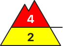
Danger level
2000m
Avalanche Problem
Persistent weak layer
2000m
Wind slab
Treeline
New snow
Treeline
Delicate avalanche situation continues
One single person can trigger slab avalanches in the drifts and old snow. If the fracture sweeps away the entire snowpack, the release can grow to large size. Danger zones occur especially on steep shady slopes and in wind-loaded gullies and bowls in all aspects. Frequency and extent of avalanche prone locations increase with ascending altitude. Also naturally triggered avalanches and remote triggerings are possible. Activities in backcountry demand defensive conduct. In zones with rain impact, increasingly frequent wet snowslides and avalanches will also be possible during the course of the day.
Snowpack
The fresh snow and fresh snowdrifts since Thursday often lie deposited on top of a loosely-packed, faceted, expansively metamorphosed old snowpack surface or atop surface hoar. Thus, bonding is poor. The old snowpack is unfavorably structured. In addition, layers inside the fresh snow and freshly generated drifts are poorly bonded in places. Avalanche releases from artificial triggerings and by winter sports enthusiasts bestätigen the trigger-sensitivity of the snowpack.
Tendency
Avalanche danger will decrease, but winter sports enthusiasts can still trigger avalanches.
EARLIER Danger level
treeline
Avalanche Problem
Wind slab
Treeline
New snow
LATER Danger level
treeline
Avalanche Problem
Wind slab
Treeline
Wet snow
1700m
Many wet snow avalanches are expected during the daytime changes
The avalanche danger is considerable above the tree line. Below this, it increases from moderate to considerable over the course of the daytime changes. The main problem is wind slab avalanches. Slab avalanches can be triggered in blown-in areas, especially on steep slopes with aspects from north to east to south and in gullies and bowls with little additional load. Avalanche prone locations can be found at all altitudes, including in forest transition areas as well as in forest aisles and clearings. Avalanches reach medium size.
In addition, the previous new snow problem will turn into a wet snow problem in the late morning. Medium-sized loose snow and slab avalanches can be triggered with little additional load. Later on, naturally triggered avalanches are to be expected from steep areas of all aspects up to an altitude of approx. 1700 metres.
Snowpack
In the leeward areas of the eastern aspects and in gullies, bowls and gaps in the forest, there are sometimes thick drift snow packs that continue to grow with the onset of wind from south-westerly directions. They are widely lying on soft layers or surface hoar and are interspersed with weak intermediate layers. In the morning, the snowfall will change to rain at medium altitudes and the soft new fallen snow will become unstable. Weak layers can collapse if moisture gets in. At high altitudes, the snowpack base often consists of faceted crystals.
Tendency
The risk of avalanches will decrease over the next few days with warmer temperatures.
Danger level
2000m
Avalanche Problem
Persistent weak layer
2000m
Wind slab
2000m
New snow
2000m
Considerable avalanche danger at high altitudes
One single person can trigger slab avalanches in the drifts and old snow. If the fracture sweeps away the entire snowpack, the release can grow to medium size. Danger zones occur especially on steep shady slopes and in wind-loaded gullies and bowls in all aspects. Frequency and extent of avalanche prone locations increase with ascending altitude. Also naturally triggered avalanches and remote triggerings are possible. Activities in backcountry demand defensive conduct. In zones with rain impact, increasingly frequent wet snowslides and avalanches will also be possible during the course of the day.
Snowpack
The fresh fallen snow from Saturday and Sunday has settled somewhat and consolidated slightly. The fresh snow and drifts since Thursday often lie deposited on top of a loosely-packed, faceted, expansively metamorphosed old snowpack surface or top surface hoar. Thus, bonding is poor. The old snowpack is unfavorably structured. In addition, layers inside the fresh fallen snow and fresh snowdrifts are prone to triggering.
Tendency
Avalanche danger receding only slowly at high altitudes
Danger level
treeline
Avalanche Problem
Wind slab
Treeline
New snow
Avoid steep slopes with drifting snow.
The avalanche risk is considerable above the tree line and moderate below it. The main problem at all altitudes is wind slab avalanches. Slab avalanches can be triggered in blown-in areas, especially on steep slopes with aspects from north to east to south and in gullies and bowls with little additional load. Avalanche prone locations can also be found in forest transition areas as well as in forest aisles and clearings. Avalanches reach medium size.
Soft new fallen snow continues to be problematic. Loose snow avalanches release themselves from the rocky steep terrain or can be triggered by a single skier on very steep slopes. The first naturally triggered avalanches are to be expected in the afternoon, especially in the forest area.
Snowpack
In the leeward areas of the eastern aspects and in gullies, bowls and gaps in the forest, there are sometimes thick drift snow packs that continue to grow with the onset of wind from south-westerly directions. They are widely lying on soft layers or surface hoar and are interspersed with weak intermediate layers. In the afternoon, the snowfall will change to rain at medium altitudes. At higher altitudes, the snowpack base often consists of faceted crystals.
Tendency
The risk of avalanches will decrease over the next few days with warmer temperatures.
Danger level
treeline
Avalanche Problem
Wind slab
Treeline
Wind slab
Treeline
Significant avalanche danger in all aspects! Even a single person can trigger a slab avalanche!
The avalanche danger is considerable above the tree line (level 3) and moderate below. Fresh snowdrift accumulations in all aspects and in some places down to forest aisles can be triggered as medium slab avalanches in many places behind ridgelines, terrain edges and in gullies and bowls even with a small additional load.
Snowpack
Up to 60 cm of new fallen snow has fallen since Thursday, partly interspersed with graupel. Stormy westerly to north-westerly winds have brought the snow to the eastern sectors on a large scale, but locally all directions and also forest aisles below the tree line can be affected. The fresh wind slab snow may contain weak layers and usually lies on an unstable layer of faceted crystals or surface hoar. In the foundation of the snow cover, kinetic metamorphism (floating snow) weakens the stability.
Tendency
Tuesday will be mild and the clouds will soften. The danger level changes little, but naturally triggered avalanches occur more frequently due to the warming.
Danger level
1800m
Avalanche Problem
Wind slab
1800m
New snow
Considerable avalanche danger at higher altitudes
Avalanche danger is considerable above 1800m, moderate below that altitude. The main problem is the fresh fallen and drifted snow. One single winter sports enthusiast can trigger small-to-medium sized slab avalanches in wind-loaded zones, particularly on steep NW-E-SE facing slopes and in gullies and bowls. In zones with rain impact, increasingly frequent wet snowslides and avalanches will also be possible during the course of the day.
Snowpack
The large amounts of fresh fallen snow from Saturday night were able to settle somewhat and slightly consolidate. The fresh snow and fresh snowdrifts since Thursday often lie deposited on top oa a loosely-packed, faceted, expansively metamorphosed old snowpack surface or atop surface hoar. Thus, bonding is poor. In addition, layers inside the fresh snow and freshly generated drifts are also poorly bonded.
Tendency
Avalanche danger receding only slowly
Danger level
treeline
Avalanche Problem
Wind slab
Treeline
New snow
1600m
Lots of new fallen snow and wind require restraint
The avalanche risk is considerable above the tree line and moderate below.
Slab avalanches can be triggered in drift and new fallen snow in some places by even a small additional load and can also slide spontaneously in places. Avalanches reach medium size. Avalanche prone locations can be found in all aspects, adjacent to the ridgeline and distant from ridgelines, behind terrain edges, in gullies and bowls. They increase in size and frequency with altitude.
Older snowdrift accumulations can be covered with snow and difficult to recognise. Cracks when walking on the snow cover, snowpack indicate danger. Spontaneous, mostly small loose snow avalanches can also occur on extremely steep terrain.
Snowpack
A total of 50 to 70 cm of new fallen snow has fallen in the last few days, with a further 10 cm added during the day. Wind and snowfall are constantly forming fresh wind slab at altitude and the snow can also bind well on the surface due to the warming. Both soft snow, surface hoar and faceted crystals above/below the top crust can serve as a weak layer. The rest of the old snowpack is made up of layers of faceted crystals, deep rime and melt-freeze crusts, where it has little tendency to break up.
The total snow depth is still well below average.
Tendency
The wind slab gradually settles as the weather warms up.
Danger level
treeline
Avalanche Problem
Wind slab
Treeline
Fresh wind slab prone to triggering
The avalanche risk is considerable above the tree line and low below.
Slab avalanches can be triggered in some places by even a small additional load and can reach medium size. Occasionally, avalanches can also slide off spontaneously. Most avalanche prone locations are located on west to north to south-east facing slopes, behind terrain edges, in gullies and bowls and also in the forest boundary area. They increase in size and frequency with altitude. Cracks when walking on the snow cover, snowpack indicate the danger. From extremely steep terrain, spontaneous, mostly small loose snow avalanches can be triggered by the sun's rays. In addition to the risk of burial, the danger of being swept away and falling must be taken into account. There are also many rocks lurking around.
Snowpack
A total of 40 to 50 cm of new fallen snow has fallen in the last few days, with a further 10 cm added during the day. Wind and snowfall are constantly forming fresh wind slabs at altitude and the snow can also bind well on the surface due to the warming. Both soft snow, surface hoar and faceted crystals above/below the top crust can serve as a weak layer for snowdrift accumulations. The rest of the old snowpack consists of layers of faceted crystals, deep rime and melt-freeze crusts and has little tendency to break up.
Below 1400 metres, rainfall moistened the snow cover on Friday, and a melt-freeze crust has formed within the new snowpack.
The total snow depth is still well below average.
Tendency
The wind slab gradually settles as the weather warms up.
Danger level
treeline
Avalanche Problem
Wind slab
Treeline
Fresh and older snowdrift accumulations are prone to disruption
The avalanche risk is considerable above the tree line and low below.
Slab avalanches can be triggered in some places by even a small additional load and occasionally slide off spontaneously. Avalanches can reach medium size. Avalanche prone locations can be found in all areas adjacent to the ridgeline and area distant from ridgelines, behind terrain edges, in gullies and bowls and also in the forest boundary area. They increase in size and frequency with altitude. Cracks when walking on the snow cover, snowpack indicate danger. Spontaneous, mostly small loose snow avalanches can also occur on extremely steep terrain when exposed to sunlight. In addition to the risk of burial, the danger of being swept away and falling must be taken into account. There are also many rocks lurking around.
Snowpack
A total of around 50 cm of new fallen snow has fallen in the last few days, with a further 10 cm added during the day. Wind and snowfall are constantly forming fresh wind slabs at altitude and the snow can also bind well on the surface due to the warming. Both soft snow, surface hoar and faceted crystals above/below the top crust can serve as a weak layer. The rest of the old snowpack is made up of layers of faceted crystals, deep rime and melt-freeze crusts, where it has little tendency to break up.
The total snow depth is still well below average.
Tendency
The wind slab gradually settles as the weather warms up.
Danger level
treeline
Avalanche Problem
Wind slab
Treeline
Beware of prone to triggering wind slab!
The avalanche risk is classified as considerable, mainly at higher altitudes, and in some cases above the tree line. Strong, sometimes stormy winds in the higher elevations have formed prone-to-triggering wind slabs that are easy to trigger. Note the drifts in the eastern sector, on the south side, but also in other aspects. Medium slab avalanches can be triggered in filled steep slopes as well as in steep bowls and gullies by even a small additional load. These avalanche prone locations should be avoided. With the significant warming, small loose snow avalanches are possible in steep terrain during the daytime changes. Wet snow avalanches are also possible in rain up to 1500 metres above sea level.
Snowpack
The recent, sometimes abundant, new fallen snow has been transported by predominantly strong winds from the west to northwest and is still poorly bonded to the old snowpack or older layers. The more extensive snowdrift accumulations, especially at higher elevations, are easy to disturb. Crystals that have been transformed by building up generally weaken the snow base, fundament. The snow cover, snowpack is distributed very differently, with well-filled areas in addition to blown-off areas.
Tendency
Significant warming leads to settlement of the snow cover, snowpack. The risk of slipping snow decreases.
Danger level
treeline
Avalanche Problem
Wind slab
Treeline
Persistent weak layer
2000m
Places with blowing snow are more dangerous
Places with blowing snow are particularly dangerous, as even a heavy load can trigger a small to medium-sized avalanche. Greater caution is needed in ravines and gullies, where there may be large amounts of blowing snow.
Snowpack
dp.4: cold following warm / warm following cold
Yesterday there was a moderate to strong northerly wind carrying fresh snow. The snow surface is uneven due to the wind. There is some light snow in sheltered areas, but the snow base is mostly hard and covered with a crust. Greater caution is needed, especially in places where wind has created new snow layers.
Tendency
It's getting warmer. Individual avalanches of southern snow will be possible from Tuesday onwards, especially in the central mountains. Above the forest line, there will still be dangerous spots of blowing snow.
Danger level
treeline
Avalanche Problem
Wind slab
Treeline
Watch out for wind slab!
The avalanche danger is classified as moderate from the tree line upwards. Strong winds have formed prone-to-triggering wind slabs that are easily triggered. Beware of drifting snow in the eastern sector, on the south side and partly also in other aspects. Medium slab avalanches can be triggered in filled steep slopes as well as in steep bowls and gullies by even a small additional load. These avalanche prone locations should be avoided. With the significant warming, small loose snow avalanches in steep terrain are possible during the daytime changes. Wet snow avalanches are also possible in rain up to 1500 metres above sea level.
Snowpack
The recent, sometimes abundant new fallen snow has been transported by predominantly strong winds from the west to northwest and is still poorly bonded to the old snowpack or older layers. The snowdrift accumulations, some of which are more extensive, are easy to disturb. Crystals that have been transformed and built up generally weaken the snow base, fundament. The snow cover, snowpack is distributed very differently, with well-filled areas in addition to blown-off areas.
Tendency
Significant warming leads to settlement of the snow cover, snowpack. The risk of slipping snow decreases.
Danger level
treeline
Avalanche Problem
Wind slab
Treeline
Fresh wind slab is still prone to triggering!
The avalanche risk is moderate above the tree line. Fresh drift snow areas can be triggered as small to medium-sized slab avalanches by low additional loads. The avalanche prone locations are located in particular in areas adjacent to the ridgeline, crest or summit in the north, east and south aspects as well as in gullies and bowls, occasionally in open forest areas.
Snowpack
Since Thursday, 15 to 30 cm of new fallen snow has fallen, which was deposited with strong winds from the west as wind slab on a soft layer of snow interspersed with graupel. Weak layers for slab avalanches form soft deposits within the fresh, bound snow layer as well as soft snow layers (new fallen snow, faceted crystals) in the transition to the crusted can form. In places, their foundations are additionally weakened by kinetic metamorphism. In general, the amount of snow is still well below average.
Tendency
On Tuesday, the snowfall and rain will soon subside and it will soften up in the afternoon. The frost line gradually rises towards 2000 metres. The wind slab problem decreases, the danger of naturally triggered avalanches increases briefly.
Danger level
treeline
Avalanche Problem
Wind slab
Treeline
Moderate avalanche danger above the tree line. Even a single person can trigger a slab avalanche!
The avalanche danger is moderate above the tree line (level 2) and low below. Fresh snowdrift accumulations, mainly in the north, east and south sectors, but locally also in other aspects and in forest aisles, can be triggered as medium slab avalanches in some places behind ridgelines, terrain edges and in gullies and bowls even with a small additional load.
Snowpack
Up to 30 cm of new fallen snow has fallen since Thursday, partly interspersed with graupel. Stormy westerly to north-westerly winds have brought the snow to the eastern sectors on a large scale, but locally all directions and also forest aisles below the tree line can be affected. The fresh wind slab often lies on an unstable layer of faceted crystals or surface hoar. In the foundation of the snow cover, kinetic metamorphism (floating snow) weakens the stability.
Tendency
Tuesday will be mild and the clouds will soften. The avalanche risk will change only slightly for the time being.
Danger level
treeline
Avalanche Problem
Wind slab
Treeline
Note small snowdrift accumulations adjacent to the ridgeline, crest or summit
The avalanche risk is moderate above the tree line and low below. In some places, wind slab adjacent to the ridgeline can be triggered as a mostly small slab avalanche by even a small additional load. Most avalanche prone locations are in the north and east sector behind terrain edges, in gullies and bowls. The risk of falling outweighs the risk of burial away from terrain traps. Also beware of stones that are only slightly covered by snow.
Snowpack
In the last few days, 10 to 20 cm of new fallen snow has fallen. Soft new fallen snow overlaid by wind slabs can form a weak layer near the surface. Overall, there is little snow and there are no pronounced weak layers within the old snowpack.
Tendency
The wind slab gradually settles as the weather warms up.
Danger level
treeline
Avalanche Problem
Wind slab
Treeline
Low avalanche danger, but watch out for fresh wind slab!
The avalanche danger is low. However, fresh snowdrift accumulations in gullies and bowls and behind ridges and ridgelines above the tree line are prone to disruption and can be triggered by individuals as small slab avalanches.
Snowpack
Fresh snowdrift accumulations often lie on faceted crystals or surface hoar, which can act as a weak layer. Apart from this, the old snow surface is covered by a few centimetres of new fallen snow. In general, kinetic metamorphism weakens the thin snow base, fundament. Windward terrain is usually blown off and almost snow-free.
Tendency
Tuesday will be mild and the clouds will soften. The avalanche risk remains low.
Danger level
Note isolated snowdrift accumulations
The avalanche danger is low. Nevertheless, there are isolated fresh snowdrift accumulations behind exposed ridges and ridgelines as well as in gullies and bowls. These can be triggered as small slab avalanches. The risk of falling outweighs the risk of burial.
Snowpack
At higher altitudes, fresh snowdrift accumulations often lie on soft layers of snow, which can act as a weak layer. A little rain and brief warming last Friday partially moistened the snow cover, where a melt-freeze crust formed with renewed cooling. In general, there is little snow.
Tendency
On Tuesday, the snowfall and rain will soon subside and it will soften up in the afternoon. The frost line gradually rises towards 2000 metres. The wind slab problem decreases, the danger of wet slides increases briefly.
Danger level
treeline
Avalanche Problem
Wind slab
Treeline
Snowdrift accumulations are prone to triggering in places!
The avalanche danger is low. Nevertheless, fresh drift snow areas can be triggered as small slab avalanches by a single person. The avalanche prone locations are located in particular in the steep terrain adjacent to the ridgeline, crest or summit in the north-west, east to south aspects as well as in gullies and bowls. The risk of being swept away and falling continues to outweigh the risk of burial.
Snowpack
Some new fallen snow was deposited by strong winds from westerly directions in the leeward areas as wind slab on a soft layer of snow interspersed with graupel. Some rain and warming last Friday partially moistened the snow cover, where a melt-freeze crust formed. Weak layers for slab avalanches form soft snow layers (new fallen snow, faceted crystals) in the transition to the crusted old snowpack, the foundation of which is occasionally weakened by kinetic metamorphism. The snow depth varies greatly. Hardness, blown and drifting snow-laden areas alternate.
Tendency
On Tuesday, the snowfall and rain will soon subside and it will soften up in the afternoon. The frost line gradually rises towards 2000 metres. The wind slab problem decreases, the danger of wet slides increases briefly.