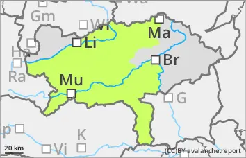
Danger level
 | 2000m |
|  |
|  |

![]()
Pay attention to prone to triggering snow packs.
There is a moderate avalanche risk above 2000 metres. Only a little new fallen snow will fall on Friday evening and Saturday night. However, the stormy westerly winds will continue to cause drifting, resulting in prone-to-triggering snowdrift accumulations. These can be triggered by individuals as small to medium-sized slab avalanches, especially behind broad ridges and ridgelines in northern, eastern and southern aspects as well as in gullies and bowls. The avalanche prone locations are easily recognisable if visibility is good.
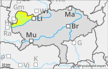
Snowpack
The existing snow cover, snowpack is strongly characterised by the wind of the last few days. The drifting snow of the last few days has mostly deposited on soft layers in transition to persistent weak layers or older wind slab. In the evening and on Saturday night, 5 to 10 centimetres of new fallen snow will fall. The strong westerly wind may cause further drift snow packs to form. The connection between them is poor at high altitudes. There are also weak layers of faceted crystals in the old snow foundation, especially on the shady slopes. The composition and thickness of the snow cover, snowpack varies greatly in a small area. There is often insufficient old snowpack.
Tendency
The snow packs remain prone to triggering. A significant change in the avalanche situation is not expected. Sunday will be sunny and cold. The wind will blow moderately to strongly from the northwest. From Monday to Wednesday, snowfall is expected from the south in wintry cold conditions.