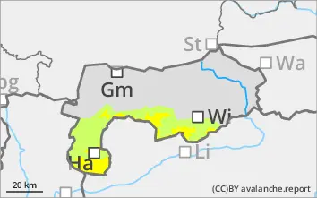
Danger level
 | 2000m |
|  |
|  |

![]()
Avoid wind slabs in the steep terrain at high altitudes!
Fresh and older wind slabs are to be noted, especially in the higher elevations, sometimes even from the tree line upwards. Strong to stormy winds from the west to north-west have caused unstable drifts to form. There are avalanche prone locations mainly in areas adjacent to the ridgeline, bowls, gullies and in places also distant from ridgelines. The triggering of slab avalanches of up to medium size is possible due to low additional loads. The mostly easily recognisable avalanche prone locations should be avoided. Be aware of the risk of falling on the hard old snowpack.
Snowpack
There will be some new fallen snow on Thursday night. The strong to stormy winds from the west to northwest over the last few days have left their mark on the snow cover, snowpack. Snowdrift accumulations may contain thin intermediate layers. There is insufficient bonding to the hardness of the old snowpack. Surface hoar has been covered. The thin old snowpack contains faceted crystals that have been transformed. The snow depths are very below average, even at high altitudes.
Tendency
No significant change in the snow and avalanche situation.