Wet-snow avalanches possible at any time or day or night due to thoroughly wet snowpack
Wet-snow avalanches possible at any time or day or night, esp. at the foot of rock walls on the Italian border. Wet-snow avalanches can fracture down to ground level and grow to large size, esp. in zones with sufficient snow. Runout zones should be avoided. Unfavorable conditions for backcountry tours.
Snowpack
dp.3: rain dp.10: springtime scenario
Heavy rainfall is expected. Weather conditions are making the snowpack ever wetter, leading to a loss of firmness inside the snowpack, resulting to loss of snowpack firmness. On steep sunny slopes below 1600m, hardly any snow on the ground.
Tendency
Due to rainfall, frequency and size of danger zones are on the increase
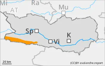
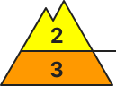
Danger level
2800m
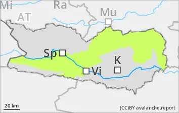
Avalanche Problem
Wet snow
2800m
Wind slab
2800m
Due to rainfall, wet-snow avalanches possible at any time or day or night. Fresh snowdrifts in high-alpine zones.
Wet-snow avalanches possible at any time or day or night, due to a thoroughly wet snowpack following a night of overcast skies., esp. at the foot of rock walls on the Italian border. Wet-snow avalanches can fracture down to ground level and grow to medium size, esp. in zones with sufficient snow. Runout zones should be avoided. Freshly generated snowdrift accumulations can often be triggered by one sole skier, esp. on very steep shady slopes above 2800m. Such danger zones occur in ridgeline terrain, in gullies and bowls. These are unfavorable conditions for backcountry tours.
Snowpack
dp.3: rain dp.6: cold, loose snow and wind
Rainfall expected up to high altitudes. Weather conditions below 2800m are leading to the snowpack becoming thoroughly wet. Following a night of overcast skies, reduced outgoing radiation and the snowpack surface can freeze only superficially, it softens swiftly in the morning. High-alpine zones: up to 20cm of fresh snowfall expected, locally more. Due to fresh fallen snow and often strong southerly winds, small new snowdrift accumulations will be generated. On steep sunny slopes below 1900m there is hardly any snow on the ground.
Tendency
pDue to rainfall, frequency and size of danger zones are on the increase
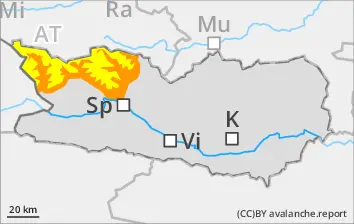
Danger level
Avalanche Problem
Wet snow
Naturally triggered wet-snow avalanches possible at any time or day or night
Wet-snow avalanches possible at any time or day or night, due to a thoroughly wet snowpack following a night of overcast skies., esp. at the foot of rock walls on the Italian border. Wet-snow avalanches can fracture down to ground level and grow to large size, esp. in zones with sufficient snow. Runout zones should be avoided. Unfavorable conditions for backcountry tours.
Snowpack
dp.3: rain dp.10: springtime scenario
Rainfall is anticipated. Weather conditions are making the snowpack thoroughly wet, leading to a loss of firmness inside the snowpack. On steep sunny slopes and below 1800m, there is hardly any snow on the ground.
Tendency
Due to rainfall, likelihood of wet-snow avalanches triggering is on the increase
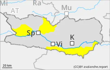
Danger level
Avalanche Problem
Wet snow
Due to rainfall, wet-snow slides possible at any time or day or night.
Due to daytime warming and solar radiation, likelihood of wet snow slides possible at any time of day or night. Runout zones should be avoided. Unfavorable conditions for backcountry tours.
Snowpack
dp.3: rain dp.10: springtime scenario
Rainfall is anticipated. Weather conditions are making the snowpack thoroughly wet, leading to a loss of firmness inside the snowpack. On steep sunny slopes and below 1800m, there is hardly any snow on the ground.
Tendency
Due to rainfall, frequency and size of danger zones are on the increase