Caution on very steep shady slopes in high-alpine zones. Beware daytime increase in avalanche danger.
Winter sports enthusiasts can often trigger small-to-medium avalanches in the old snow. Danger zones occur mostly on very steep NW/N/NE-facing slopes and are difficult to recognize. Backcountry skiing tours demand a very conscious route selection. In high-altitude ridgeline terrain, fresh snowdrifts require caution. During the course of the day, avalanche danger increases to Danger Level 2. Especialy on sun-basked steep slopes, small-to-medium wet-snow and glide-snow avalanches are possible. Backcountry tours should be launched early, and brought to an end early in the day.
Snowpack
On very steep shady slopes at high altitudes, unfavorable intermediate layers are often evident in the old snowpack. Where there is no wind impaxct, the uppermost layers of often soft. The old snowpack is thoroughly wet up to high altitudes. Following good nocturnal outgoing longwave radiation the melt-freeze crust is capable of bearing loads in early morning hours. During the course of the day, it softens up from east-to-south-to-west, increasingly also on shady slopes, and thereby forfeits its firmness.
Tendency
Danger of dry-snow avalanches will recede. Further warming on Saturday, the zero-degree level will lie at 3300m. Danger of wet-snow and glide-snow avalanches will increase during the course of the day - significantly.
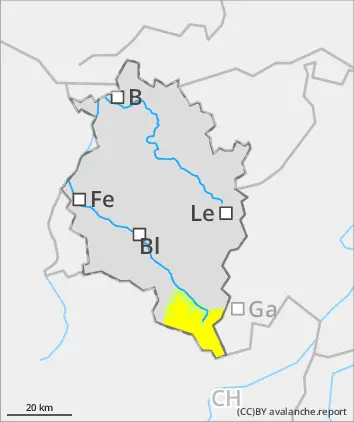
BEFORE NOON Danger level
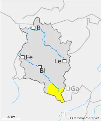
AFTERNOON Danger level
Avalanche Problem
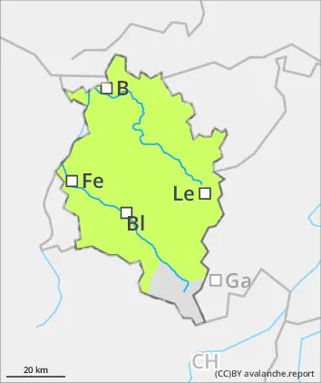
Wet snow
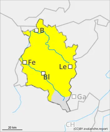
Gliding snow
Predominantly favorable conditions in the morning. Beware slight daytime rise in danger.
Following good nocturnal outgoing longwave radiation the melt-freeze crust is capable of bearing loads in early morning, good conditions with low avalanche danger. Isolated triggerings are possible in extremely steep terrain by large additional loading. Apart from the danger of being buried in snow masses, the risks of being swept along and forced to take a fall require adequate caution. In high-altitude ridgeline terrain, fresh snowdrift accumulations require caution. Due to daytime warming and solar radiation, the snowpack forfeits its firmness and danger rises to Danger Level 2, moderate. Esp. on sun-basked steep slopes, small-to-medium wet-snow and glide-snow avalanches are possible. Backcountry tours should be launched early and brought to a close early in the day.
Snowpack
The old snowpack is thoroughly wet up to high altitudes. Following good nocturnal outgoing longwave radiation the melt-freeze crust is capable of bearing loads in early morning hours. During the course of the day, it softens up from east-to-south-to-west, increasingly also on shady slopes, and thereby forfeits its firmness. In high-alpine regions, small-area snowdrift accumulations are evident. At lower altitudes there is little snow on the ground.
Tendency
Danger of dry-snow avalanches will recede only slowly. On Friday, much warmer, zero-degree level at 3000m. Danger of wet-snow and glide-snow avalanches will increase.