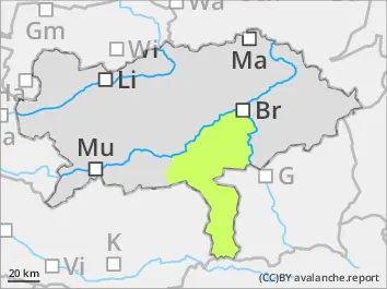
Danger level
 |
|  |  | |||||
|  |
|  |


![]()
Slightly increasing wet-snow avalanche danger during the course of the day
The avalanche danger is low and increases slightly during the course of the day. Due to warming and sun radiation predominantly small, sometimes medium sized wet loose-snow avalanches can trigger. Danger spots are found especially in full, steep gullies and slopes of all expositions. Weak layers within the old snow can be triggered only by high additional loads in extremely steep shady slopes and lead to dry slab avalanches.
Snowpack
The snow cover can settle during the night. During the day the snow cover which is wet till the base, softens and loses its stability. In steep shady slopes weak layers of faceted snow are found within the snow base.
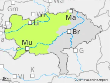
Tendency
Friday night the weather is changing. The snowline is 1.200 m in the north and 1.500 m in the south and 10-30 cm new snow is expected. The most will be in Nordstau areas. Visibility will be poor. Northerly winds which are increasing during the day. The avalanche danger increases with altitude.