EARLIER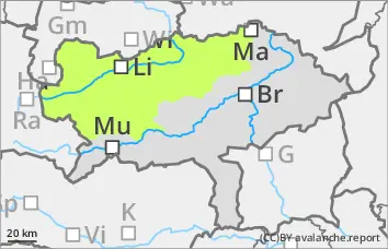
Danger level
 |
LATER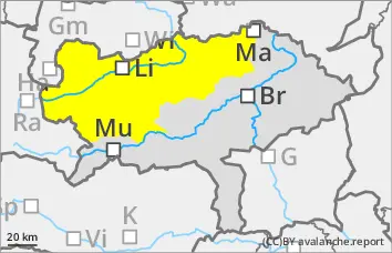
Danger level
 |
|  |  | |||||
| | |

Increase in avalanche danger during the day changes
The avalanche risk is low in the morning hours and increases to moderate during the daytime changes. There is a danger of wet loose snow and slab avalanches from undischarged terrain as incoming radiation and warming increase. These can release themselves or be triggered by a small additional load from people and are usually small to medium-sized. Avalanches can reach areas that are already snowed out.
Snowpack
The snowpack can consolidate on a clear night. A surface crust forms on the surface. However, it quickly softens again with sunlight and warming. In shady, higher areas, there are large crystals in the lower snow layering in some places, which act as a possible weak layer. The deglaciation is progressing rapidly.
Tendency
High pressure will lead to bright and sunny mountain weather on Friday and Saturday. Temperatures at an altitude of 2000 metres will rise from -1 degrees on Friday morning to +6 degrees on Saturday afternoon. With the increasing warming and sunshine, the activity of wet snow avalanches will increase again.