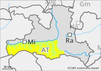
The avalanche danger is subject to daytime changes. Below 2400 m, it is initially low and increases to moderate in the morning. Wet loose snow avalanches can occur spontaneously with strong incoming radiation or be triggered by winter sports and reach medium size. Wet slab avalanches are possible where there is still a lot of snow, i.e. mainly on shady slopes at high altitudes and partly on eastern and western slopes. If the terrain is unfavourable, avalanches can also penetrate into green areas.
Snowpack
After a clear night, the melt-freeze crust is widespread and softens and loses firmness in the morning. The snowpack underneath consists of compact snow characterised by rain. On shady slopes from around 2400 metres, there are weak layers of deep rime in the old snowpack near the ground. The snowpack is moist to wet up to high altitudes. Low altitudes and sunny slopes at medium altitudes are mostly covered in snow.
Tendency
No significant change on Friday. Note the daytime changes in avalanche danger.
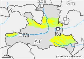
EARLIER Danger level
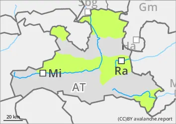
2400m
Avalanche Problem
Persistent weak layer
2400m
LATER Danger level
2800m
Avalanche Problem
Wet snow
2800m
Persistent weak layer
2400m
Daytime decreasing firmness with solar radiation
The avalanche risk is initially low below around 2400 m and increases to moderate in the morning. Spontaneous or artificially triggered wet loose snow avalanches are possible in a few places, in particular from very steep terrain below around 2800 m where there is still a lot of snow. In wet snow, avalanches can tear through to the ground, reach medium size and, if the terrain is unfavourable, advance into the green.
Above around 2400 m, there are still individual avalanche prone locations in the west, north and east aspects, as well as in the southern sector in the high Alps, where slab avalanches can be triggered in persistent weak layers. Take care on the steep transitions from little to lots of snow.
Snowpack
After a clear night, the melt-freeze crust is widespread and, depending on the exposure, softens in the morning and then loses firmness. In shady high altitudes, the 5 to 15 cm of new fallen snow from the beginning of the week is well settled and often still soft. The snowpack below consists of compact snow characterised by rain up to high altitudes. On shady slopes from around 2400 metres, there are still weak layers of angular forms and deep rime in the old snowpack close to the ground. Low altitudes and sunny slopes at medium altitudes are mostly covered in snow.
Tendency
No significant change on Friday. Note the daytime changes in avalanche danger.
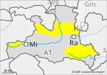
Danger level
Avalanche Problem
Wet snow
Small, spontaneous wet snow avalanches during the daytime changes
The avalanche risk is low. In very few places in the terrain, small wet slab avalanches or loose snow avalanches are possible due to additional load or spontaneously. This increases the risk of avalanches in the fall terrain.
Snowpack
There is still snow in shady locations or at high altitudes, but sunny steep terrain often no longer has a large area of continuous snowpack up to at least medium altitudes or has already tapped out. The snow surface is usually crusted in the morning and softens in the morning depending on the exposure. In the Nockberge mountains, however, the strong wind slows down the snowmaking process.
Tendency
No significant change on Friday. Note the daytime changes in avalanche danger.