Danger level
 | 1800m |
|  |
|  | ||||
| |
|  |


![]()
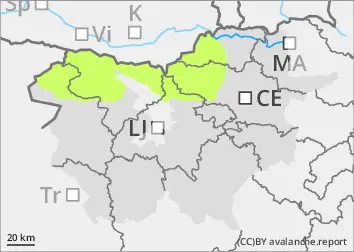
Some wet snow avalanche cannot be ruled out
The snowpack is mostly well connected and generally stable. During the day, wet snow avalanches are possible in places. Weak layers in old snow deeper in the snowpack also pose a minor danger. These weak layers are more common in the axis above the forest. In particular, a small to medium avalanche can be triggered by a large load exceeding the load-bearing capacity of these layers.
Snowpack
dp.10: springtime scenario
A cloudier night will only frost the snowpack at higher altitudes in the High alpine regions. During the day, the snow will become heavier and may become unstable in places. In the old snow cover, the snow layers are mostly well connected. More or less deep below the surface, there are several weak layers of shreds and discontinuous grains, which are more frequent on axial slopes.
Tendency
Tuesday will be cloudy and foggy. Local showers, partly showers, will occur. The snowfall level will be around 2000 m above altitudes, with weaker showers at higher altitudes. Snowfall may be 10 to 20 cm in the high alpine regions of the Julian Alps and less elsewhere. The danger of avalanches will increase slightly.