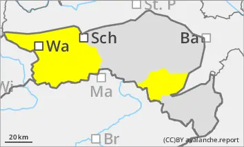
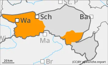
Increase in avalanche danger already in the morning!
Spontaneous wet snow avalanches are likely! The avalanche danger increases considerably during the daytime changes!
The avalanche danger is assessed as moderate in the morning. Wet slab avalanches can be triggered even under low additional load. The avalanche risk increases to considerable (level 3) during the daytime changes with the very mild temperatures and the strong sunlight appropriate for the time of year. In some places, especially in steep gullies and bowls, spontaneous wet loose snow and slab avalanches are to be expected. These usually reach medium size. Wechten breaks can trigger naturally triggered avalanches.
Snowpack
Due to the rain on Saturday, the clouds in the night to Sunday and the marked rise in temperature, the snowpack is already wet in the morning. Only at higher elevations can a thin melt-freeze crust form overnight. Due to the very mild temperatures, the snowpack will quickly become wet on the sunny slopes. On shady slopes, the melt-freeze crust opens up and the moisture of the snowpack increases.
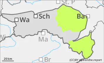
Weak layers between the consolidated wind slab and the old snowpack in shady high altitudes can become prone to triggering again as the snowpack becomes increasingly moist. In the Rax-Schneeberg area, there is little snow below 1400 metres.
Tendency
A weak cold front will pass through on Easter Monday. This will bring isolated rain showers. The slight drop in temperature will reduce the risk of avalanches somewhat.
EARLIER Danger level
Avalanche Problem
Wet snow
Gliding snow
LATER Danger level
Avalanche Problem
Wet snow
Gliding snow
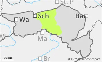
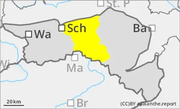
Increase in avalanche danger already in the morning!
The avalanche danger increases to moderate! Some spontaneous wet snow avalanches, occasional gliding sluffs!
The avalanche risk increases to moderate (level 2) during the daytime changes. Due to the very mild temperatures and the strong sunlight for the time of year, there will be an increase in wet loose snow and slab avalanches, especially on sunny slopes. Gliding avalanches are also possible. The avalanches usually occur spontaneously, but remain mostly small. Only occasionally can they reach medium size.
Snowpack
Due to the rain on Saturday, the clouds in the night to Sunday and the marked rise in temperature, the snowpack is already wet in the morning. On sunny slopes and at low altitudes, the snowpack will become wet during the day. There will be little snow below 1000 metres.
Tendency
A weak cold front will pass through on Easter Monday. This will bring isolated rain showers. The slight drop in temperature will reduce the risk of avalanches somewhat.
Danger level
Low avalanche danger.
The avalanche risk is categorised as low. Due to the very mild temperatures, a wet snow slide may still occur occasionally if there are sufficient snow reserves.
Snowpack
The snowpack is already wet in the morning and gets wetter during the daytime changes. In the Bucklige Welt and on the Hochwechsel there is very little snow below 1400 metres. In the Gutenstein Alps, the hills up to 1000 metres are already mostly bare. With the mild temperatures, the remaining snowpack will melt away quickly.
Tendency
A weak cold front will pass through on Easter Monday. This will bring isolated rain showers. The avalanche risk remains low.