Danger level
 |
|  |  |

![]()
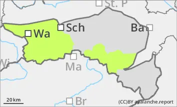
Low avalanche danger. Occasional wet snow slides are possible.
The avalanche risk is low. With the arrival of rain, wet snow slides are possible in the afternoon from the few steep slopes that are not unloaded. In the high areas on shady slopes, small slab avalanches can occasionally be triggered in the old snow. In general, the risk of falling and injury clearly outweighs the risk of burial. Take care in partly icy, steep gullies.
Snowpack
A melt-freeze crust forms overnight. On sunny slopes, the snow softens quickly in the morning. In shady areas, the melt-freeze crust lasts into the afternoon. In summit areas, the snow surface is hard and partly icy due to wind and rain. In gullies and bowls, the wind slab is well stabilised. Faceted crystals are weakening the snow base, fundament in the northern sector. There is little snow below 1400 metres and below 1600 metres on sunny slopes.
Tendency
The avalanche danger remains low. On Thursday, a weak disturbance will bring a little more cloud and less sunshine. Local rain showers are possible in the afternoon. The frost line will be around 2000 metres. The wind will remain weak.