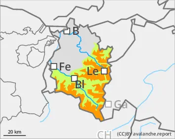
Daytime rise in wet-snow activity. Backcountry touring terrain: weak old snow.
Well settled fresh snow and drifts blanket a weak old snowpack. Wherever the melt-freeze crust on the snowpack surface is not capable of bearing loads, avalanches can be triggered even by one single winter sports enthusiast, particularly in little-skied terrain on west-, north-, and east-facing slopes, and on steep sunny slopes over 2600m. Danger zones occur especially in places where the snow tends to be shallow and in transitions from shallow to deep snow. Remote triggerings are possible. Avalanches can grow to large size and then flow over flat passages. As a result of daytime warming and solar radiation. wet-snow avalanches are possible, particularly on south- and west-facing slopes. If these fracture down to deeper layers inside the snowpack they can grow to large size. On steep grass-covered slopes, glide-snow avalanches can slide away. Zones below glide cracks should be avoided.
Snowpack
The large amounts of fresh snow and drifts from last week have settled well. As a result of nocturnal outgoing radiation, a melt-freeze crust often forms on the surface. On shady slopes where there has been heavy rain impact up to about 2100m, in other aspects up to about 2400m, this crust is capable of bearing loads. Due to solar radiation, the crust softens up rapidly during the day. Widespread in the lowermost part of the snowpack there are cup-shaped crystals which are unbonded. The unusual avalanche activity over the last week confirms just how prone to triggering the weak old snowpack really is. In zones which have not yet discharged, this state persists (except in heavily-skied on terrain).
Tendency
As the result of a weak cold front on Sunday, minor snowfall above 1300-1500m is anticipated. As temperatures drop, the gliding snow and wet-snow avalanche activity will decrease. At higher altitudes, the situation for winter sports enthusiasts is treacherous in little-used terrain.
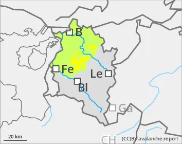
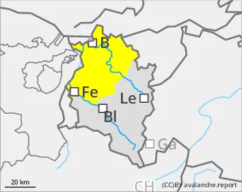
EARLIER Danger level
1800m
Avalanche Problem
Persistent weak layer
1800m
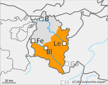
LATER Danger level
Avalanche Problem
Wet snow
Persistent weak layer
1800m
Wet-snow avalanches during the course of the day
Due to daytime warming and solar radiation, wet loose-snow avalanches can be expected particularly on south- and west-facing slopes. Isolated wet-snow avalanches can grow to large size, whenever they fracture down to deeper levels of the snowpack. On steep grass-covered slopes, glide-snow avalanches can occur. Zones with glide cracks on the surface should under all circumstances be avoided. Particularly on very steep shady slopes above 1800m, avalanches can fracture down to deeper-down layers inside the snowpack, especially where the snowpack is not capable of bearing loads.
Snowpack
During nights of clear skies, a melt-freeze crust capable of bearing loads frequently forms on the snowpack surface. Due to solar radiation, it rapidly softens up during the day. The snowpack is moist-to-wet over far-reaching areas. Above 1800m on shady slopes, there are still weak layers in the lowermost part of the snowpack fundament.
Tendency
As the result of a weak cold front on Sunday, minor snowfall above 1300-1500m is anticipated. As temperatures drop, the gliding snow and wet-snow avalanche activity will decrease.