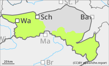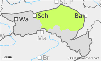
Danger level
 |

Low avalanche danger, but watch out for older wind slabs in the north and east aspects!
The avalanche risk is low. In a few places, pillows of wind drifted snow can be triggered as small slab avalanches, especially in extremely steep and shady gullies and bowls. Avalanche prone locations as well as icy areas are often covered by some new fallen snow. Beware of persistent danger of falling!
Snowpack
There is still significantly less snow than average. A thin layer of fresh snow, only wind-worked in places, is covering the often hard old snowpack or pale areas. Surface hoar could form in places. Small, older pillows of wind drifted snow lie on a thin, crusted old snowpack, especially in shady areas. The connection between them is still poor in places. In addition, angular shapes can weaken the snow base, fundament.
Tendency
Often friendly mountain weather, no significant change in avalanche danger.
