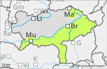
Danger level
 | 1800m |
|  |
|  |

![]()
Persistent weak layer problem in the northern sector!
The avalanche risk is rated as moderate above 1,800 metres and low below that. Slab avalanches can be triggered in some places even with little additional load and can reach medium size when breaking through the persistent weak layer. The danger areas are located in particular in the north to east aspects behind ridgelines and terrain edges as well as in the entrance areas to steep gullies and bowls.
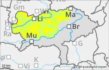
Snowpack
In the higher elevations, older wind slab snow lies in the northern and eastern exposures on an unstable snowpack with weak layers of faceted crystals and floating snow. On the sunny slopes, the snowpack is mostly settled and quite compact. Due to outgoing longwave radiation, surface hoar continues to grow, especially in shady areas.
Tendency
Several disturbances will cause changeable weather at the weekend. Already on Saturday there will be temporary unproductive snowfall, then from Sunday afternoon an Adriatic low will bring new fallen snow to the mountains. The avalanche risk will hardly change until the snowfall on Sunday.