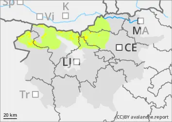
Danger level
 | 2400m |
|  |
|  | ||||
| |
|  |


![]()
Careful on blowing snow! Above 2400 m there are weak layers in the old snow cover.
A small additional load can trigger a small to medium avalanche, especially near ridges where there are fresh snow drifts, especially above 1800 m. At altitudes above 2400 m, a small load can trigger a small to medium avalanche of packed snow. During the day, if the weather is sunny, the snow on the slopes will become thinner and in many places will creep down. On steep grassy slopes, the whole snow cover may creep down.
Snowpack
dp.6: cold, loose snow and wind
The last snow fell on uneven ground - in some places on dry ground, especially on the southern slopes on drifts of blown snow. The north-easterly wind has moved snow above the tree line and built up drifts - especially above 1800 m where there is more dry snow. There are weak layers in the old snow cover above 2400 m.
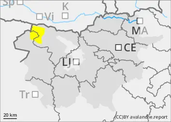
Tendency
Tuesday will see slightly less wind, but the weather and snow cover stability will remain the same as on Monday.