BEFORE NOON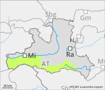
Danger level
 |
AFTERNOON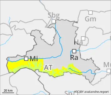
Danger level
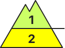 | 3000m |
|  |
|  |

Wet-snow activity will increase during the course of the day
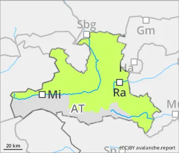
Avalanche danger below 3000m will increase from low to moderate during the course of the day, esp. below 3000m small (in very isolated cases medium-sized) wet-snow avlanches can trigger naturally or be triggered by persons. Also isolated small-to-medium glide-snow avalnches are possible. Above 2800m, small dry-snow slab avalanches are possible in isolated cases, triggered by minimum additional loading, esp. on wind-loaded extremely steep shady slopes and in gullies.
Snowpack
The by and large compact but far below-average snowpack is moist/wet up to 2800-3200m. The melt-freeze crust in early morning is usually capable of bearing loads, but rapidly softens due to higher daytime temperatures and solar radiation.
Tendency
Little change is anticipated. Also in the next few days, beware the daytime danger cycle.