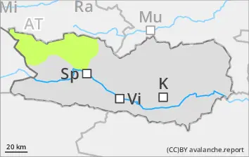
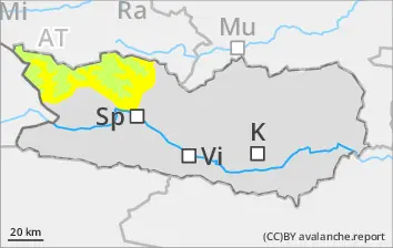
Wet-snow avalanches are small but can be triggered even by one sole skier in isolated cases, esp. at the foot of rock walls along the Italian border following nights of overcast skies. Especially in summit zones, isolated small wet loose-snowslides are possible. Due to rainfall, the likelihood of wet-snow avalanches triggering will increase somewhat. Many starting zones are already discharged completely.
Snowpack
dp.10: springtime scenario
Nocturnal outgoing longwave radiation is quite good, the snowpack surface freezes enough to be capable of bearing loads. Weather conditions are stabilising the snowdrift accumulations. Below 1800m hardly any snow on the ground.
Tendency
No significant change expected
Danger level
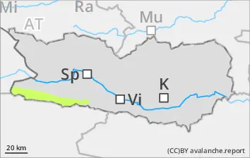
Isolated danger zones
Only isolated mostly small wet-snow avalanches are still possible during the course of the day. Caution urged in gulies in the major areas of precipitation. The runout zones should be give great attentiveness.
Snowpack
Weather conditions have led to the snowpack becoming thoroughly wet. Many starting zones have completely discharged.
Tendency
No significant change expected.
BEFORE NOON Danger level
AFTERNOON Danger level
2800m
Avalanche Problem
Wet snow
2800m
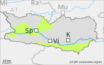
Danger of wet-snow avalanches will increase during the day. Danger levels occur esp. along the Salzburg border.
Due to daytime warming and solar radiation, likelihood of wet-snow avalanches triggering will increase. Below 2800m mostly small releases are possible, esp. along the Salzburg border. Caution urged esp. on very steep slopes and at the foot of rock walls. Snowdrift accumulations are no longer very trigger-sensitive. Isolated danger zones occur on shady slopes above 2800m.
Snowpack
dp.10: springtime scenario dp.6: cold, loose snow and wind
Nocturnal outgoing longwave radiation is quite good, the snowpack surface freezes enough to be capable of bearing loads. Sunshine and higher daytime temperatures lead to significant softening of the snowpack during the morning hours. The lowermost part of the snowpack is wet on shady slopes below 2800m and on sunny slopes below 3200m. Weather conditions are stabilising the snowdrift accumulations. Below 2200m hardly any snow on the ground.