Avalanche danger is low. In isolated cases, small glide-snow or wet-snow avalanches can release in steep terrain which has not yet discharged or it can be triggered by persons. Above 2600m slab avalanches can be triggered in very isolated cases in the freshly generated snowdrift accumulations.
Snowpack
Fresh snow (max. 10cm) will fall on bare ground on sunny slopes, on shady slopes largely atop a thoroughly wet snowpack surface, but bond well with it. Due to lower temperatures, the snowpack will regain some firmness.
Tendency
Little change expected
Danger level
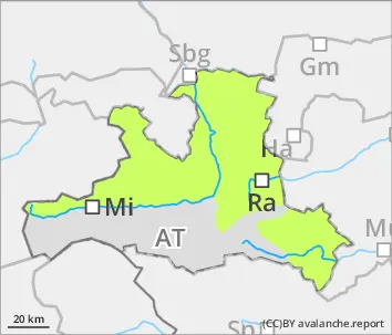
2600m
Avalanche Problem
Wind slab
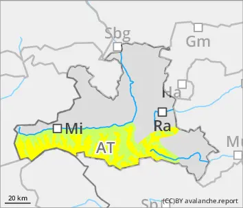
2600m
Dropping temperatures plus fresh snow plus wind: moderate snowdrift problem at high altitudes
Avalanche danger above 2600m is moderate. Freshly generated snowdrift accumulations are triggerable in a few places by low additional loading, esp. on north-facing slopes above 2600m, in other aspects higher up. Avalanche releases are mostly small, in isolated cases medium-sized. In steep terrain which has not yet discharged, small-to-medium wet-snow avalanches can trigger naturally at any time of day or night, or else be triggered by winter sports enthusiasts. Also isolated small-to-medium glide-snow avalanches are possible.
Snowpack
Fresh snowfall (10-20cm) amid wind impact deposited atop a rather compact snowpack up to high altitudes (2600-2800m) which is moist/wet. Above 2600m the near-surface layers of graupel and other soft layers inside the snowpack are potential weak layers. The thoroughly wet snowpack at low altitudes is regaining a certain firmness through the lower temperatures.
Tendency
No significant change expected. Regionally, another 10cm of fresh snow could be added.