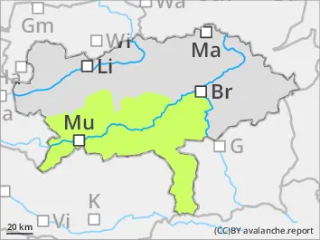
BEFORE NOON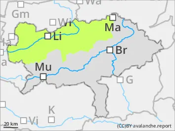
Danger level
 |
AFTERNOON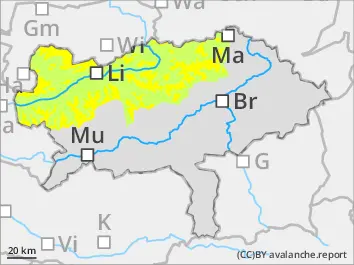
Danger level
 | 1600m |
|  |
|  |

The avalanche danger is increasing during the course of the day.
Avalanche danger is in general low in the morning but will increase to moderate during the course of the day in areas with high amounts of snow on sunny slopes. Loose wet-snow avalanches which could be triggered in extremly steep, rocky slopes can be sponaneously triggered. Thes avalanches are mostly small to medium sized.
Snowpack
The snow base has settled and is predominantly stable. The snow surface is mostly icy or with hoar. On top of that is a powder-like layer in high altitudes. The surface in sunny areas gets quickly moist and wet. During the night the snow cover can cool down and solidify.
Tendency
The sunny high-pressure system weather will last throughout the whole week. The avalanche danger will decrease.