Naturally triggered wet-snow avalanches will increase with the daytime danger cycle. Wet-snow avalanches can be triggered by winter sports enthusiasts and grow to medium size. These avalanche prone locations are located particularly on very steep high-altitude slopes.
Snowpack
dp.10: springtime scenario
Weather conditions are making the snowpack ever wetter, leading to a loss of firmness inside the snowpack, resulting to loss of snowpack firmness. Many starting zones have already completely dishcharged. Nocturnal outgoing longwave radiation hardly exists. The snowpack surface can barely freeze and softens rapidly. The snowpack is thoroughly wet. On steep sunny slopes below 1600m, hardly any snow on the ground.
Tendency
Little change in avalanche danger levels
BEFORE NOON Danger level
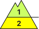
2800m
Avalanche Problem
Wet snow
2800m
Wind slab
2600m
AFTERNOON Danger level
Avalanche Problem
Wet snow
Wind slab
2600m
Beware snowdrifts in high-alpine zones, wet-snow problem lower down
Avalanche danger is moderate, on steep slopes below 2800m which have not yet discharged, small-to-medium moist/wet-snow avalanches can releases spontaneously, esp. with extended sunshine windows, or be triggered by persons. Also isolated small-to-medium glide-snow avalanches are possible. Danger zones for small snowdrifts occur in shady wind-loaded gullies and bowls above 2800m. Dry-snow slab avalanches can be triggered here by one sole skier. Isolated avalanches can fracture down to the wet layers and sweep them along, thereby growing to medium size.
Snowpack
The snowpack is moist or wet up to high altitutudes, contains melt-freeze crusts even though the snowpack is quite compact overall, weak layers are isolated but occur above 2500m. In some places in this compact, moist old snowpack there are a few cm of fresh snow lying atop it. Dry weak layers of faceted crystals exist only on shady slopes above 2800m. Due to storm-strength southerly foehn winds, small snowdrift accumulations have been generated over the last few days, esp. on very steep shady slopes, deposited them atop weak layers where they are prone to triggering.
Tendency
Springtime situation: slight daytime danger cycle. The snowdrift problem is receding.
Danger level
2800m
Avalanche Problem
Wet snow
2800m
Wind slab
2800m
Due to rainfall, wet-snow avalanches possible at any time or day or night. Fresh snowdrifts in high-alpine zones.
Naturally triggered wet-snow avalanches will increase with the daytime danger cycle. Wet-snow avalanches can be triggered by winter sports enthusiasts and grow to medium size. These avalanche prone locations are located particularly on very steep slopes below 2800m. Fresh snowdrift accumulations can be triggered by one sole skier on very steep shady slopes above 2800m. Such danger zones occur esp. in ridgeline terrain, in gullies and in bowls. In high-alpine zones, small-to-medium moist loose-snow avalanches can be expected, esp. on extremely steep sunny slopes.
Snowpack
dp.10: springtime scenario dp.6: cold, loose snow and wind
Weather conditions below 2800m are leading to the snowpack becoming thoroughly wet. Many wet-snow avalanches have already released, many starting zones have completely discharged, the snowpack is thoroughly wet. Nocturnal outgoing longwave radiation hardly exists. The snowpack surface can barely freeze and softens rapidly. High-alpine zones: up to 20cm of fresh snowfall registered, locally more. Due to fresh fallen snow and often strong southerly winds, small new snowdrift accumulations will be generated. On steep sunny slopes below 1900m there is hardly any snow on the ground.
Tendency
No significant change expected
BEFORE NOON Danger level
2200m
Avalanche Problem
Wet snow
2200m
AFTERNOON Danger level
Avalanche Problem
Wet snow
Snowpack
Tendency
Danger level
1800m
Avalanche Problem
Wet snow
1800m
Snowpack
The snowcover is depending on height and exposition wet or moist. On southern exposed sloped the snow has almost fully retreated till high altitudes. During the night the firming and setteling of the snow cover is not possible due to the lack of radiation caused by clouds. the snow cover is moist, wet and soft from the morning on. The retreatment increases.
Tendency
Danger level
1600m
Avalanche Problem
Wet snow
1600m
New snow
1600m
Spontaneous wet-snow avalanches from steep terrain possible at any time!
The avalanche danger is moderate above 1.800 m. Danger spots are located in steep shady slopes. There spontaneous wet-snow avalanches are possible any time or can be triggered by an individual. On smooth surfaces gliding-snow avalanches are still possible. Avoid areas below glide cracks. Avalanches are small to medium sized.
Snowpack
The snowcover is isothermal and till high altitudes wet or moist. On southern exposed sloped the snow has almost fully retreated and the retreatment increases.
Tendency
The Easter weekend will be sunny and mild in the mountains. The retreatment of the snowcover increases and the avalanche danger decreases.
BEFORE NOON Danger level
Avalanche Problem
Wet snow
Wind slab
2600m
AFTERNOON Danger level
Avalanche Problem
Wet snow
Wind slab
2600m
Isolated medium-sized wet-snow and glide-snow avalanches
Avalanche danger is moderate. In a few places on steep slopes which have not yet discharged, small-to-medium moist/wet avalanches can trigger naturally, esp. when windows of sunshine are more extended, or be triggered by winter sports enthusiasts. In isolated cases, small-to-medium glide-snow avalanches are possible.
Snowpack
The still evident snowpack below 2000m has turned to summer-firn snow. Even above that altitude the snow is moist or wet, contains melt-freeze crusts, though the overall somepack is quite compact. In places, there are a few cm of fresh snow deposited atop this old snowpack surface.
Tendency
Springtime situation: slight daytime danger cycle due to wet-snow avalanche activity
BEFORE NOON Danger level
1600m
Avalanche Problem
Gliding snow
1600m
AFTERNOON Danger level
1600m
Avalanche Problem
Wet snow
1600m
Gliding snow
1600m
Isolated wet-snow and glide-snow avalanches
Snowpack
Tendency
On the weekend, often sunny and mild. Avalanche danger levels will recede further and be subject to a daytime danger cycle.
BEFORE NOON Danger level
1600m
Avalanche Problem
Gliding snow
1600m
AFTERNOON Danger level
1600m
Avalanche Problem
Wet snow
1600m
Gliding snow
1600m
Increasing avalanche danger in daytime danger cycle
Avalanche danger is low in the morning hours, then rises to moderate in the afternoon above 1600m. Main problem: wet snow. On slopes with sufficient snow in extremely steep terrain, wet loose-snow avalanches can trigger naturally or be triggered by persons on extremely steep slopes. Danger zones will increase during the course of the day. Loose-snow avalanches are mostly small-sized. Wet glide-snow avalanches can trigger at any time of day or night over smooth slopes, grass-covered terain, in sparsely wooded zones and over smooth rock plates. Glide-snow avalanches can reach medium size in isolated cases.
Snowpack
A melt-freeze crust forms during the nighttime hours in many places, then softens up due to daytime warming. At high altitudes, a few cm of fresh snow lie deposited atop a moist old snowpack surface. All in all, the snowpack in all aspects is thoroughly wet up to high altitudes. At high altitudes the layers inside the snowpack are dissolving. On south-facing slopes up to high altitudes, hardly any snow on the ground. On shady slopes, there is snow on the ground above 1400m.
Tendency
Due to lacking nocturnal outgoing radiation, avalanche danger levels increase more quickly
BEFORE NOON Danger level
2600m
Avalanche Problem
Wet snow
2600m
Wind slab
2600m
AFTERNOON Danger level
2600m
Avalanche Problem
Wet snow
2600m
Wind slab
2600m
Main danger: wet-snow avalanches. Beware fresh snowdrifts in high-alpine zones.
Snowpack
Tendency
Danger level
Avalanche Problem
Wet snow
Beware wet snow. Isolated danger zones.
Naturally triggered wet-snow avalanches will increase with the daytime danger cycle. Wet-snow avalanches can be triggered by winter sports enthusiasts, mostly small releases. Isolated avalanche prone locations lie on very steep high-altitude slopes.
Snowpack
dp.10: springtime scenario
Weather conditions are leading to the snowpack becoming thoroughly wet. Many wet-snow avalanches have already released, many starting zones have completely discharged, the snowpack is thoroughly wet, very little snow in some regions. Nocturnal outgoing longwave radiation hardly exists. The snowpack surface can barely freeze and softens rapidly. On steep sunny slopes and below 1800m there is hardly any snow on the ground.
Tendency
No significant change expected
Danger level
Avalanche Problem
Wet snow
On north-facing slopes still larger, area-wide snowfields evident
Avalanche danger is low. Wet snow can be problematic on slopes with sufficient snow. On smooth, very steep slopes which have not yet discharged, small wet loose-snow avalanches are possible in all aspects. On steep slopes with a smooth ground, wet glide-snow avalanches can trigger naturally. Frequency of danger zones can increase slightly during the course of the day.
Snowpack
At night in many places, a melt-freeze crust forms, then softens during the morning hours. The snowpack which remains is thoroughly wet. On south-facing slopes up to high altitudes, hardly any snow on the ground. On shady slopes, there is snow on the ground above 1400m.
Tendency
Avalanche danger levels will not change significantly
Danger level
1800m
Avalanche Problem
Wet snow
1800m
Only little amount of snow, but spontaneous wet-snow avalanches from steep shady slopes are possible.
The avalanche danger is low. Nevertheless danger spots are located ind very steep shady slopes. There spontaneous small sized wet-snow avalanches are possible.
Snowpack
The snowcover is isothermal and till high altitudes wet or moist. On southern exposed sloped the snow has almost fully retreated and the retreatment increases.
Tendency
The Easter weekend will be sunny and mild in the mountains. The retreatment of the snowcover increases and the avalanche danger decreases.
Danger level
Avalanche Problem
Wet snow
Isolated danger zones
Avalanche danger is low. In isolated cases, small glide-snow or wet-snow avalanches can release in steep terrain which has not yet discharged.
Snowpack
What little snow there is, is moist-to-wet, in other words, summer-firn.
Tendency
Slight daytime danger cycle (wet-snow activity) within the same Danger Level