Wet-snow avalanches possible at any time or day or night, due to a thoroughly wet snowpack
Wet-snow avalanches possible at any time or day or night, due to a thoroughly wet snowpack following a night of overcast skies., esp. at the foot of rock walls on the Italian border. Wet-snow avalanches can fracture down to ground level and grow to medium size, esp. in zones with sufficient snow. Runout zones should be avoided.
Snowpack
dp.10: springtime scenario
Following a night of overcast skies, reduced outgoing radiation and the snowpack surface can freeze only superficially, it softens swiftly in the morning. Weather conditions are making the snowpack ever wetter.
Tendency
Due to rainfall, likelihood of wet-snow avalanches triggering is on the increase
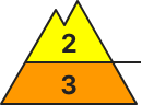
Danger level
2800m
Avalanche Problem
Wet snow
2800m
Persistent weak layer
2500m
Danger of wet avalanches even in the morning. Caution on very steep shady slopes in high-alpine zones.
Snowpack
On E/S/W-facing slopes up to high-alpine regions and on shady slopes up to 2200m, the moist snowpack is able to consolidate somewhat during the nighttime hours. Due to rainfall in the afternoon up to 2500m, the snowpack will be further weakened. On very steep shady slopes at high altitudes, unfavorable intermediate layers are evident inside the old snowpack.
Tendency
As the snowpack becomes thoroughly wet, danger of wet-snow and glide-snow avalanches increases.
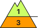
Danger level
2800m
Avalanche Problem
Wet snow
2800m
Gliding snow
2800m
Persistent weak layer
2600m
Wet-snow avalanches are the main danger, they can trigger naturally at any time of day or night
Avalanche danger below 2800m is considerable, above that altitude danger is moderate. Wet-snow avalanches can release naturally in all aspects and grow to medium size. Esp. on steep W/N/E-facing slopes, increasingly frequent slab avalanches are possible. Thy can sweep along the thoroughly wet snowpack and grow to large size, esp. in high-altitude starting zones where there is sufficient snow. Avalanches in steep gullies can in isolated cases plummet down to green zones. In very steep grass-covered terrain, medium-sized glide-snow avalanches can trigger naturally all day long. Above 2600m on extremely steep slopes in extended northern aspects, isolated medium-sized slab avalanches can be triggered by one sole skier.
Snowpack
The snowpack below 2600m is at least moistened in all aspects, on sunny slopes often up to high-alpine regions thoroughly wet. The snowpack cannot sufficient radiate outwardly during the nocturnal hours, forms only a thin melt-freeze crust not capable of bearing loads, and softening quickly in the morning hours. High air moisture and local rainfall is making the snowpack even wetter. Weak layers of faceted crystals evident only on extremely steep shady slopes above 2600m.
Tendency
Due to additional water seepage into the snowpack from rainfall, it is becoming thoroughly wet to a greater degree. Increasingly frequent wet-snow and glide-snow avalanches up to high-alpine zones.
Danger level
2800m
Avalanche Problem
Wet snow
2800m
Wet-snow avalanches possible at any time or day or night, due to a thoroughly wet snowpack
Wet-snow avalanches possible at any time or day or night, due to a thoroughly wet snowpack following a night of overcast skies., esp. at the foot of rock walls on the Italian border. Wet-snow avalanches can fracture down to ground level and grow to medium size, esp. in zones with sufficient snow. Runout zones should be avoided.
Snowpack
dp.10: springtime scenario
Following a night of overcast skies, reduced outgoing radiation and the snowpack surface can freeze only superficially, it softens swiftly in the morning. Weather conditions are making the snowpack ever wetter.
Tendency
Due to high air moisture, likelihood of wet-snow avalanches triggering is on the increase
Danger level
Avalanche Problem
Wet snow
Wet-snow avalanches possible at any time of day or night due to a thoroughly wet snowpack
Due to air moisture, danger of wet-snow avalanches rises significantly during the course of the day - to Danger Level 2, Moderate. Wet slab avalanches are possible. Wet-snow avalanches can fracture down to ground level and thus grow to medium size. Runout zones should be avoided.
Snowpack
dp.10: springtime scenario
Overcast skies during the nightttime hours, outgoing longwave radiation is much reduced. The snowpack can freeze only superficially and softens rapidly in early morning. Weather conditions are making the snowpack ever wetter.
Tendency
Due to rainfall, likelihood of wet-snow avalanches triggering is on the increase
Danger level
Avalanche Problem
Wet snow
Gliding snow
Moderate avalanche danger due to wet-snow avalanches
Avalanche danger is moderate. Danger zones for wet-snow avalanches occur on very steep shady slopes below 2600m, on very steep sunny slopes at all altitudes. Wet-snow avalanches can trigger naturally at any time of day or night and grow to medium size Esp. on very steep W/N/E-facing slopes, increasingly frequent wet slab avalanches are possible, triggered either naturally or by persons. Avalanches in steep gullies can in isolated cases plummet down to the green zones. In very steep grass-covered terrain, isolated mostly small-sized glide-snow avalanches can trigger naturally.
Snowpack
The snowpack below 2600m is at least moistened in all aspects, on sunny slopes often up to high-alpine regions thoroughly wet. The snowpack cannot sufficient radiate outwardly during the nocturnal hours, forms only a thin melt-freeze crust not capable of bearing loads, and softening quickly in the morning hours. High air moisture and local rainfall is making the snowpack even wetter. Weak layers of faceted crystals evident only on extremely steep shady slopes above 2600m. On very steep, smooth slopes, the entire snowpack can glide away.
Tendency
The snowpack is becoming thoroughly wet. Main danger: wet-snow and glide-snow avalanches.
Danger level
1600m
Avalanche Problem
Wet snow
1600m
Naturally triggered wet-snow avalanches still possible
Avalanche danger above 1600m is moderate, below that altitude dange ris low. Main problem: a thoroughly wet snowpack. Naturally triggered wet-snow and slab avalanches are possible esp. on extremely steep slopes. On very steep smooth slopes which have not yet discharged, e.g. over meadows, in sparsely wooded zones or over smooth rock plates, glide-snow avalanches are possible at any time of day or night. AVOID all zones below glide cracks. Above 1600m, esp. on shady slopes where the snow is sufficient, wet-snow avalanches can grow to medium size.
Snowpack
Mild temperatures, dense cloud cover, showerlike rainfall: the snowpack is becoming thoroughly wet. Hardly any snow on south-facing slopes up to high altitudes.
Tendency
The snowpack is gradually receding, and with it, avalanche danger.
Danger level
1600m
Avalanche Problem
Wet snow
1600m
Gliding snow
1600m
Danger of wet-snow avalanches even in the morning
Following a mild night with overcast skies and reduced outgoing radiation, moderate danger prevails. Naturally triggered wet-snow and glide-snow avalanches can be expected, reaching medium size in high-altitude starting zones. Wet-snow avalanches can be triggered by persons in steep terrain. Due to rainfall, danger below 2400m could rise somewhat. Fresh snowdrifts require attentiveness in very high ridgeline terrain. In addition, the old snowpack can be triggered by large additional loading in extremely steep terrain. Apart from the danger of being buried in snow masses, the risks of being swept along and forced to take a fall require adequate caution.
Snowpack
On E/S/W-facing slopes up to high-alpine regions and on shady slopes up to 2200m, the moist snowpack is able to consolidate somewhat during the nighttime hours. Due to rainfall in the afternoon up to 2500m, the snowpack will be further weakened. On very steep shady slopes at high altitudes, unfavorable intermediate layers are evident inside the old snowpack.
Tendency
As the snowpack becomes thoroughly wet, danger of wet-snow and glide-snow avalanches increases.
BEFORE NOON Danger level
AFTERNOON Danger level
1600m
Avalanche Problem
Wet snow
1600m
Predominantly good avalanche situation in the morning.
The avalanche danger differs during the course of the day. In the morning good conditions. In the late morning the danger of wet loose-snow avalanches increases. Due to warming triggered from all expositions are possible.
Snowpack
The snowcover is depending on height and exposition wet or moist. Due to sun radiation the snow cover looses its strength even n summit areas.
Tendency
No significant change of the avalanche danger. The Easter week stays mild. The zero degrees line is above 3.000 m.
BEFORE NOON Danger level
AFTERNOON Danger level
1600m
Avalanche Problem
Wet snow
1600m
Snowpack
Tendency
Danger level
Avalanche Problem
Wet snow
Little snow on the ground, only small-sized wet avalanche releases
Avalanche danger is low. Wet snow can be problematic. On smooth, very steep slopes which have not yet discharged, small wet glide-snow avalanches are possible in all aspects. Where the snow on the ground is sufficient, small naturally triggered wet loose-snow avalanches are possible.
Snowpack
Mild temperatures, dense cloud cover, showerlike rainfall: the snowpack is becoming thoroughly wet. Hardly any snow on south-facing slopes up to high altitudes.
Tendency
Avalanche danger levels will remain low.
Danger level
Avalanche Problem
Wet snow
Gliding snow
Small-sized wet-snow and glide-snow avalanches can trigger naturally
Avalanche danger is low. During the course of the day, likelihood of small wet-snow avalanches triggering on sunny steep slopes will increase somewhat. Runout zones below very steep snow-covered gullies and grass-covered slopes should be avoided.
Snowpack
Little snow on the ground. The melt-freeze crust is often capable of bearing loads, but gradually softens in the morning and forfeits its bonding. On very steep, smooth slopes the entire snowpack can glide away in places.
Tendency
Little change expected. The snowpack is becoming wetter, slightly increasing danger of wet-snow and glide-snow avalanches.
Danger level
Avalanche Problem
Wet snow
Likelihood of wet-snow slides will rise during daytime hours
Due to daytime warming and solar radiation, likelihood of wet snow slides will increase during the course of the day. Runout zones should be avoided. Some starting zones have already completely discharged.
Snowpack
dp.10: springtime scenario
Nocturnal outgoing longwave radiation will be quite good. The snowpack surface will freeze and be capable of bearing loads in early morning, softening subsequently over the course of the day. As of midday, sunshine and warmth will make the snowpack increasingly wet. Below 1600m there is hardly any snow on the ground.