During the course of the day, wet-snow problem intensifies swiftly. At high altitudes, caution towards persistent weak layers.
Avalanche danger above 2200m is moderate, below that altitude danger is low in the morning and rises to moderate during the course of the day. Wet loose-snow and slab avalanches can be triggered by large additional loading in some places below 2600m and grow to medium size, either triggered by persons or naturally. Slab avalanches can trigger in the old snow in some places by large additional loading. Caution urged in transitions from shallow to deep snow. Esp. on W/N/E-facing slopes above 2200m, avalanches can fracture down to more deeply embedded layers of the snowpack and grow to large size. On extremely steep sunny slopes below 2600m, wet loose-snow and slab avalanches of medium size are possible, naturally triggered or person-triggered. On steep grass-covered slopes below 2400m, medium-sized glide-snow avalanches are possible.
Snowpack
The snowpack has settled, the surface is often encrusted in early morning. Weak layers inside the fresh fallen snow have consolidated well. In transitions to the old snowpack above 2000m, faceted crystals often form a weak layer. In the lower and middle parts of the snowpack above 2200m there are weak layers of faceted crystals which are embedded between crusts. Below 2000m the entire snowpack is moist. Melt-freeze crusts and snowpack itself soften up during the day, the snowpack can forfeit its bonding thereby. Where the ground was bare of snow before the recent precipitation, the entire snowpack can slide away as a glide-snow avalanche.
Tendency
Activity of wet-snow avalanches will recede as temperatures drop. The persistent weak layer problem will persist.
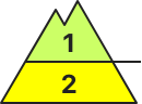
BEFORE NOON Danger level
2400m
Avalanche Problem
Persistent weak layer
2400m
AFTERNOON Danger level
2700m
Avalanche Problem
Wet snow
2700m
Persistent weak layer
2400m
Rapidly rising danger of wet-snow avalanches. Beware persistent weak layers.
Due to solar radiation and daytime warmth, increasingly frequent wet-snow avalanches can be expected, including medium-sized releases, on very steep E/S/W-facing slopes, esp. below 2700m. Morning: acute danger of falls on the hardened crust on steep dlopes. Weak layers in the uppermost part of the snowpack can in isolated cases be triggered by one sole skier, danger zones occur esp. on steep N/W/E-facing slopes above 2400m. Isolated danger zones also occur on steep south-facing slopes above 2600m. Isolated avalanches can fracture down to more deeply embedded layers of the snowpack and grow to medium size.
Snowpack
dp.10: springtime scenario dp.1: deep persistent weak layer
Inside the old snowpack on N/W/E-facing slopes there are faceted, expansively metamorphosed weak layers, esp. abov 2400m. Clear skies over far-reaching areas: the surface freeze enough so that it can bear loads. Sunshine and warmth moisten the snowpack during the daytime, esp. on very steep E/S/W-facing slopes including at high altitudes, swiftly softening the snowpack which becomes thoroughly wet at low and intermediate altitudes. Below 1700m there is hardly any snow on the ground.
Tendency
Little change in avalanche danger levels anticipated
BEFORE NOON Danger level
2100m
Avalanche Problem
Persistent weak layer
2100m
AFTERNOON Danger level
Avalanche Problem
Wet snow
Persistent weak layer
2100m
Beware persistent weak layers. Rising daytime danger of wet-snow avalanches.
Due to solar radiation and daytime warmth, increasingly frequent wet-snow avalanches can be expected, including medium-sized releases, on very steep E/S/W-facing slopes, esp. below 2700m. Morning: acute danger of falls on the hardened crust on steep dlopes. Weak layers in the uppermost part of the snowpack can in isolated cases be triggered by one sole skier, danger zones occur esp. on steep N/W/E-facing slopes above 2400m. Isolated danger zones also occur on steep south-facing slopes above 2600m. Isolated avalanches can fracture down to more deeply embedded layers of the snowpack and grow to medium size.
Snowpack
dp.10: springtime scenario dp.1: deep persistent weak layer
Inside the old snowpack on N/W/E-facing slopes there are faceted, expansively metamorphosed weak layers, esp. abov 2100m. Clear skies over far-reaching areas: due to low temperatures and low air moisture, surface crusts will form. Sunshine and warmth will moisten the snowpack during the daytime. The snowpack at low and intermediate altitudes is moist. Below 1500m there is little snow on the ground.
Tendency
Little change in avalanche danger levels anticipated
BEFORE NOON Danger level
2400m
Avalanche Problem
Persistent weak layer
2400m
Wet snow
AFTERNOON Danger level
Avalanche Problem
Wet snow
Persistent weak layer
2400m
Caution on very steep shady slopes in high-alpine zones. Beware daytime rise in temperature.
The recent snowdrifts are still prone to triggering, one sole skier can trigger small-to-medium sized avalanches. Danger zones occur in very steep NW/N/NE-facing slopes which are difficult to recognize, they increase with ascending altitude. Backcountry tours require an well-considered route selection. Avalanche danger increases during the course of the day. Particularly in intensively sun-bathed steep terrain, increasingly also on shady slopes, small-to-medium wet-snow avalanches are possible. The danger of small, in isolated cases medium-sized glide-snow avalances remains difficult to assess. Backcountry tours need to be brought to a close early in the day.
Snowpack
At high altitudes, unfavorable intermediate layers in the old snowpack are evident. Bonding deteriorates with increasing altitude, especially in the uppermost and between intermediate layers. On steep shady slopes the uppermost layers of the snowpack are often soft, on sunny slopes already bonded and in the early morning hours capable of bearing loads. The snowpack is throughly wet up to high altitudes but all-in-all well consolidated. Due to daytime rise in temperatures and solar radiation, the snowpack weakens as the day unfolds.
Tendency
Danger of dry-snow avalanches not expected to change in high alpine zones. Due to dropping temperatures on Sunday, danger of wet-snow avalanches will diminish. Glide-snow avalanches are still difficult to predict.
BEFORE NOON Danger level
2200m
Avalanche Problem
Persistent weak layer
2200m
Gliding snow
AFTERNOON Danger level
Avalanche Problem
Wet snow
Gliding snow
Persistent weak layer
2200m
Increasing wet snow problem due the course of the day
The avalanche danger is low in the morning but increases to moderate during the course of the day. Danger of small to medium sized wet loose-Snow avalanches on steep sunny slopes due to warming and radiation. These can trigger spontaneously or by individuals. On steep grassy or forest slopes gliding snow avalanches can trigger spontaneously. Slab avalanches are possible in some places in shady steep slopes in high altitudes.
Snowpack
Due to the mild temperatures and the strong radiation the snow cover could settle. During the night stable surface hoar is forming which will quickly soften during the day on sunny slopes. Partially the softening is limited due to strong winds. The snow cover is moist up to high altitudes and gets even more moist looses it’s strength and bonding. The whole snow cover could begin to glide especially on bare soils. Weak layers which are prone to triggering are only found in high altitudes on shady slopes within the old snow cover (Graupel, soft crystals).
Tendency
Saturday night the temperature will drop with 10-15 degrees but without precipitation. The wet snow problem is decreasing due to the cooling but there will be persistent weak layers in high altitudes.
BEFORE NOON Danger level
1400m
Avalanche Problem
Gliding snow
1400m
AFTERNOON Danger level
1400m
Avalanche Problem
Wet snow
1400m
Gliding snow
1400m
Snowpack
Tendency
BEFORE NOON Danger level
Avalanche Problem
Wet snow
AFTERNOON Danger level
1600m
Avalanche Problem
Wet snow
1600m
Isolated loose-snow avalanches can trigger on shady slopes
Avalanche danger is low and rises to moderate in afternoon above 1600m. Wet snow is the major problem, wet loose-snow avalanches can trigger naturally or be triggered by skiers on sunny, extremely steep slopes, frequency of danger zones increases during the course of the day. Avalanches can grow to medium size. In some places, snowdrifts can trigger a slab avalanches by large additional loading. Danger zones occur in steep ridgeline terrain and in wind-loaded gullies and bowls, releases can reach medium size. On very steep grass-covered slopes and on very steep smooth ground, glide-snow avalanches can be expected, these can reach medium size in isolated cases.
Snowpack
A thin melt-freeze crust forms during the nighttime hours, then softens swiftly in the morning sunshine. During the day, mild temperatures up to high altitudes are moistening the snowpack, causing it to forfeit its firmness. Snow is still powdery only on steep shady slopes at high altitudes, but there, embedded graupel and weak layers in the uppermost part of the snowpack can be prone to triggering. At intermediate altitudes the fresh fallen snow is thoroughly wet over widespread areas. Gliding movements are possible.
Tendency
With temperatures dropping, the danger of wet-snow avalanches will diminish.
BEFORE NOON Danger level
Avalanche Problem
Wet snow
AFTERNOON Danger level
1600m
Avalanche Problem
Wet snow
1600m
Favorable conditions in the morning. Beware daytime warmth.
Avalanche danger in the morning is low. Winter sports enthusiasts can trigger avalanches in extremely steep terrain, usually small releases. Apart from the danger of being buried in snow masses, the risks of being swept along and forced to take a fall require adequate caution. Due to daytime warming and solar radiation esp. on sun-bathed and rocky steep terrain, but also on shady slopes to an increasing degree, slides and mostly small-sized wet-snow avalanches are possible. Small, in isolated cases medium-sized glide-snow avalanches continue to be possible.
Snowpack
The old snowpack is thoroughly wet up to high altitudes, but following a night of clear skies with good outgoing radiation, a generally well consolidated snowpack awaits in early morning. During the course of the day, the snowpack will soften from east to south to west and lose its firmness. At lower altitudes there is little snow on the ground.
Tendency
Dropping temperatures on Sunday will cause danger of wet-snow avalanches to diminish. Small glide-snow avalanches still possible.
BEFORE NOON Danger level
2600m
Avalanche Problem
Gliding snow
2600m
AFTERNOON Danger level
2600m
Avalanche Problem
Wet snow
2600m
Gliding snow
2600m
Increasing wet-snow problem during daytime hours
Avalanche danger is initially low, then rises during the daytime to moderate below 2600m. On extremely steep sunny slopes below 2600m, wet loose-snow avalanches of medium size are possible due to daytime warming and solar radiation, either triggered naturally or by persons. Also medium-sized glide-snow avalanches can trigger naturally in very steep grass-covered terrain. In isolated cases on steep shady slopes above 2200m, mostly small slab avalanches can be triggered.
Snowpack
The snowpack has settled, the surface is often encrusted in early morning. Weak layers inside the fresh fallen snow have consolidated well. In transitions to the old snowpack above 2000m, faceted crystals often form a weak layer. In the lower and middle parts of the snowpack above 2200m there are weak layers of faceted crystals which are embedded between crusts. Below 2000m the entire snowpack is moist. Melt-freeze crusts and snowpack itself soften up during the day, the snowpack can forfeit its bonding thereby. Where the ground was bare of snow before the recent precipitation, the entire snowpack can slide away as a glide-snow avalanche.
Tendency
Activity of wet-snow avalanches will recede as temperatures drop. The persistent weak layer problem will persist.
Danger level
Avalanche Problem
Wet snow
On south-facing slopes, hardly enough snow on the ground for avalanches
Avalanche danger is low. Wet snow can be problematic in isolated cases. Due to daytime warming, mostly small, wet loose snow slides trigger naturally on extremely steep slopes.
Snowpack
During the night, a melt-freeze crust will form, then swiftly melt in the sunshine next morning. Older snowdrift accumulations have consolidated somewhat. In many places graupel is embedded. At intermediate altitudes the fresh fallen snow was frequently deposited on moist ground which was previously bare of snow. South-facing slopes are losing their snow cover.
Tendency
Avalanche danger is not expected to change significantly.
Danger level
Avalanche Problem
Wet snow
Wet and gliding snow avalanches during the course of the day increasing.
The avalanche danger is low. Spontaneous small wet loose-snow avalanches due to warming and sun radiation are possible anytime spontaneously or be triggered by individuals i. Gliding snow avalanches are possible in very steep grass slopes within high amounts of snow reserves.
Snowpack
Due to the mild temperatures and the strong radiation the snow cover could settle. During the night surface hoar is forming which will quickly soften during the day. The snow cover is moist up to high altitudes and looses it’s strength and bonding. In medium to low altitudes bare soils.
Tendency
Saturday night the temperature will drop with 10-15 degrees but without precipitation. The wet snow problem is decreasing due to the cooling but there will be persistent weak layers in high altitudes.
Danger level
Avalanche Problem
Wet snow
On south-facing slopes, hardly enough snow on the ground for avalanches
Avalanche danger is low. Wet snow is the main problem. Due to daytime warming, mostly small, wet loose snow slides trigger naturally on extremely steep slopes. Frequency of danger zones increases during the daytime hours. On very steep grass-covered slopes, isolated small glide-snow avalanches are possible.
Snowpack
A thin melt-freeze crust forms during the nighttime hours, then softens swiftly in the morning sunshine. During the day, mild temperatures up to high altitudes are moistening the snowpack, causing it to forfeit its firmness. Older snowdrift accumulations have consolidated somewhat. In many places graupel is embedded which can be prone to triggering. At intermediate altitudes the snowpack is deposited on wet ground. South-facing slopes are becoming bare of snow.
Tendency
With temperatures dropping, the danger of wet-snow avalanches will diminish.
Danger level
Avalanche Problem
Wet snow
Beware naturally triggered avalanche activity due to rising daytime temperatures
Avalanche danger is low. On extremely steep sunny slopes, increasingly frequent wet loose-snow avalanches, mostly small releases, are possible due to daytime warming. They can release naturally or be triggered by a winter sports enthusiast. In addition, small-to-medium glide-snow avalanches can trigger on very steep grass-covered slopes.
Snowpack
The snowpack has settled well, it is melt-freeze encrusted in early morning. Weak layers inside the fresh fallen snow have consolidated. Above 2200m on north-facing slopes there are weak layers of faceted crystals in the lowermost part of the snowpack in some places. Below 2000m the old snow is moist, after nights of cloudy skies it softens quickly during the morning hours and forfeits its bonding.
Tendency
Activity of wet-snow avalanches will recede as temperatures drop. T
Danger level
Avalanche Problem
Wet snow
Rapidly rising daytime danger of wet-snow avalanches.
Due to daytime warming and solar radiation, increasingly frequent wet-snow avalanches can be expected, mostly small-sized releases, esp. on steep E/S/W-facing slopes. In the morning: beware falls on the hardened crusts.
Snowpack
dp.10: springtime scenario
Clear skies over far-reaching areas, surface crusts will form and freeze which are capable of bearing loads. Sunshine and warmth will rapidly soften the snowpack on E/W/S-facing slopes during the daytime. The snowpack at low and intermediate altitudes is thoroughly wet. Below 1600m there is hardly any snow on the ground.
Tendency
Little change in avalanche danger levels anticipated