Snow still powdery only on high-altitude shady slopes
Avalanche danger above 2200m is moderate in the morning, rises in the afternoon from low to moderate at all altitudes. Snowdrift accumulations are the major problem, esp. on sunny, extremely steep slopes where slab avalanches can trigger naturally. Frequency of danger zones increases during the course of the day. Avalanches can grow to medium size. In some places, snowdrifts can trigger a slab avalanches by large additional loading. Danger zones occur in steep ridgeline terrain and in wind-loaded gullies and bowls, releases can reach medium size. On very steep grass-covered slopes and on very steep smooth ground, glide-snow avalanches can be expected, these can reach medium size in isolated cases.
Snowpack
A thin melt-freeze crust forms during the nighttime hours, then softens swiftly in the morning sunshine. During the day, mild temperatures up to high altitudes are moistening the snowpack, causing it to forfeit its firmness. Older snowdrift accumulations have consolidated somewhat. In many places graupel is embedded which can be prone to triggering. Snow is still powdery only on high-altitude shady slopes. At intermediate altitudes the fresh fallen snow was frequently deposited on moist ground which was previously bare of snow. Gliding movements are possible.
Tendency
Temperatures will drop on the weekend, the snowpack will stabilize somewhat.
BEFORE NOON Danger level
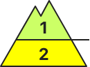
2200m
Avalanche Problem
Persistent weak layer
2200m
AFTERNOON Danger level
2200m
Avalanche Problem
Persistent weak layer
2200m
Wet snow
2600m
Persistent weak layers are main danger
Avalanche danger above 2200m is low, below that altitude danger is low in the morning and rises to moderate during the course of the day. Slab avalanches can be triggered by large additional loading in some places. Esp. on W/N/E-facing slopes above 2200m, avalanches can fracture down to more deeply embedded layers of the snowpack and grow to large size. On extremely steep sunny slopes below 2600m, wet loose-snow and slab avalanches of medium size are possible, naturally triggered or person-triggered. On steep grass-covered slopes below 2400m, medium-sized glide-snow avalanches are possible.
Snowpack
Due to daytime warming the snowpack is rapidly settling, above 2000m there are faceted crystals forming a weak layer. In the lower and middle parts of the snowpack above 2200m there are weak layers of faceted crystals which are embedded between crusts. Below 2000m the old snow is sticky or moist, after nights of cloudy skies it softens quickly during the morning hours and forfeits its bonding. Over ground which previously was bare of snow the fresh fallen snow can glide away as a glide-snow avalanche.
The recent snowdrifts are prone to triggering, one sole skier can trigger small-to-medium sized avalanches. Danger zones occur in steep shady ridgeline terrain and wind-loaded gullies and bowls, they increase with ascending altitude.Due to daytime warming and solar radiation, mostly small loose-snow avalanches are possible esp. on sun-basked and rocky steep slopes. The danger of small, in isolated cases medium-sized glide-snow avalances remains difficult to assess.
Snowpack
Recent fresh fallen snow plus N/E winds have generated fresh snowdrift accumulations which often lie deposited atop a soft, at intermediate altitudes atop an encrusted old snowpack surface. Bonding deteriorates with increasing altitude. On steep shady slopes the uppermost layers of the snowpack are often soft, on sunny slopes already bonded and in the early morning hours capable of bearing loads. The snowpack is throughly wet up to high altitudes but all-in-all well consolidated.
Tendency
Danger of dry-snow avalanches not expected to change. Due to warmth and solar radiation, increasingly frequent slides and loose-snow avalanches expected.
BEFORE NOON Danger level
2100m
Avalanche Problem
Persistent weak layer
2100m
AFTERNOON Danger level
Avalanche Problem
Wet snow
Persistent weak layer
2100m
Beware persistent weak layers. Rising daytime danger of wet-snow avalanches.
Weak layers in the uppermost part of the snowpack can in isolated cases be triggered by one sole skier, they occur esp. on steep N/W/E-facing slopes above 2100m, avalanches can grow to medium size. Due to daytime warming and solar radiation, increasingly frequent wet-snow avalanches can be expected, also medium-sized releases, esp on very steep sunny slopes. In the morning hours: danger of falling on the hardened crusts in steep terrain.
Snowpack
dp.10: springtime scenario dp.1: deep persistent weak layer
Inside the old snowpack on N/W/E-facing slopes there are faceted, expansively metamorphosed weak layers, esp. abov 2100m. Clear skies over far-reaching areas: due to low temperatures and low air moisture, surface crusts will form. Sunshine and warmth will moisten the snowpack during the daytime. The snowpack at low and intermediate altitudes is moist. Below 1500m there is little snow on the ground.
Tendency
Rising danger of wet-snow avalanches due to daytime warming and solar radiation
BEFORE NOON Danger level
2400m
Avalanche Problem
Persistent weak layer
2400m
AFTERNOON Danger level
2700m
Avalanche Problem
Wet snow
2700m
Persistent weak layer
2400m
Beware persistent weak layers. Rising danger of wet-snow avalanches.
Weak layers in the uppermost part of the snowpack can in isolated cases be triggered by one sole skier, they occur esp. on steep N/W/E-facing slopes above 2100m, avalanches can grow to medium size. Due to daytime warming and solar radiation, increasingly frequent wet-snow avalanches can be expected, also medium-sized releases, esp on very steep sunny slopes. In the morning hours: danger of falling on the hardened crusts in steep terrain.
Snowpack
dp.10: springtime scenario dp.1: deep persistent weak layer
Inside the old snowpack on N/W/E-facing slopes there are faceted, expansively metamorphosed weak layers, esp. abov 2400m. Clear skies over far-reaching areas: due to low temperatures and low air moisture, surface crusts will form. Sunshine and warmth will moisten the snowpack during the daytime. The snowpack at low and intermediate altitudes is moist. Below 1700m there is little snow on the ground.
Tendency
Rising danger of wet-snow avalanches due to daytime warming and solar radiation
BEFORE NOON Danger level
2000m
Avalanche Problem
Persistent weak layer
2000m
Gliding snow
2400m
AFTERNOON Danger level
2400m
Avalanche Problem
Wet snow
2400m
Gliding snow
2400m
Persistent weak layer
2000m
Snowpack
Tendency
BEFORE NOON Danger level
2200m
Avalanche Problem
Persistent weak layer
2200m
Gliding snow
AFTERNOON Danger level
Avalanche Problem
Wet snow
Gliding snow
Persistent weak layer
2200m
Wet and gliding snow avalanches during the course of the day, in high altitudes snowdrift is prone to triggering - avalanche danger moderate!
The avalanche danger is in general moderate. Consider spontaneous wet- and gliding snow avalanches. Due to mild temperatures and strong radiation gliding snow avalanches are possible anytime and especially from steep sunny areas spontaneous medium sized wetsnow avalanches are possible. In high altitudes and steep slopes slab avalanches can be triggered by small additional loads.
Snowpack
The snow cover can settle furthermore due to mild temperatures and strong radiation and can get moist on the surface especially on sunny slopes. Powder snow is only found in shady slopes in high altitudes. Older thicker snowdrift deposits can contain weak layers. Wetness from the ground can lead to destabilization of the snow cover.
Tendency
Friday will be sunny in the mountains. The tendency to be prone to triggering of the snowdrift deposits is decreasing. The wet snow problem increases especially in the southern expositions.
BEFORE NOON Danger level
Avalanche Problem
Wet snow
Wind slab
1800m
AFTERNOON Danger level
Avalanche Problem
Wet snow
Wind slab
1800m
Snow becoming moist also on shady slopes
Avalanche danger rises from low to moderate during the afternoon hours. Wet snow is the main problem. Due to daytime warming, mostly small, wet loose snow slides trigger naturally on extremely steep slopes. Frequency of danger zones increases during the daytime hours. At high altitudes, snowdrifts can be a problem, they can be triggered as small slab avalanches in steep ridgeline terrain and in wind-loaded gullies and bowls by large additional loading. On very steep grass-covered slopes, isolated small glide-snow avalanches are possible.
Snowpack
A thin melt-freeze crust forms during the nighttime hours, then softens swiftly in the morning sunshine. During the day, mild temperatures up to high altitudes are moistening the snowpack, causing it to forfeit its firmness. Older snowdrift accumulations have consolidated somewhat. In many places graupel is embedded which can be prone to triggering. At intermediate altitudes the snowpack is deposited on wet ground. South-facing slopes are becoming bare of snow.
Tendency
Temperatures will drop on the weekend, the snowpack will stabilize somewhat.
BEFORE NOON Danger level
Avalanche Problem
Wet snow
AFTERNOON Danger level
1600m
Avalanche Problem
Wet snow
1600m
Favorable conditions. Beware daytime warming.
One sole skier can trigger small-to-medium sized avalanches in the fresh snow and fresh drifts, releases mostly small-sized. Danger zones are often blanketed, difficult to recognize, they occur in steep ridgeline terrain and in wind-loaded gullies and bowls and tend to increase in frequency with ascending altitude. Whumpf noises and glide cracks when you tread upon the snowpack surface are indicators of possible danger. Also naturally triggered avalanches are possible. Small-to-medium glide-snow avalanches are still possible.
Snowpack
Recent fresh fallen snow plus N/E winds have generated fresh snowdrift accumulations which often lie deposited atop a soft, at intermediate altitudes atop an encrusted old snowpack surface. The snowpack is throughly wet up to high altitudes but all-in-all well consolidated. At low altitudes the fresh fallen snow lies on bare ground.
Tendency
Danger of dry-snow avalanches further receding. Due to warmth and solar radiation, increasingly frequent slides and loose-snow avalanches expected.
BEFORE NOON Danger level
2400m
Avalanche Problem
Gliding snow
2400m
AFTERNOON Danger level
2600m
Avalanche Problem
Wet snow
2600m
Gliding snow
2400m
Snowdrift accumulations still prone to triggering but difficult to recognize
Avalanche danger is moderate. On extremely steep sunny slopes, naturally triggered (or person-triggered) avalanches of medium size are possible due to daytime warming and solar radiation. Avalanches can be triggered in the snowdrift accumulations in some places by minimum additional loading, esp. on steep shady slopes. Drifts are hard to recognize due to the fresh snow blanketing them, releases can grow to medium size. On extremely steep sunny slopes below 2000m, increasingly frequent wet loose-snow avalanches of medium size are possible due to daytime rising temperatures and solar radiation. Also medium-sized glide-snow avalanches are possible on very steep grass-covered slopes.
Snowpack
Due to daytime warming the snowpack is further settling, layers inside the snowpack are well consolidated. Above 2200m there are faceted crystals forming a weak layer in the lower part of the snowpack. Inside the old snowpack fundament on north-facing slopes above 2200m and on W/S/E-facing slopes above 2400m, there are faceted crystals. Below 2000m the old snow is sticky or moist, after nights of cloudy skies it softens quickly during the morning hours and forfeits its bonding. Over ground which previously was bare of snow the fresh fallen snow can glide away as a glide-snow avalanche.
Tendency
Wet-snow problem at high altitudes is dimishing
Danger level
Avalanche Problem
Wet snow
Wet and gliding snow avalanches during the course of the day increasing.
The avalanche danger is low. Consider spontaneous wet- and gliding snow avalanches. Due to mild temperatures and strong radiation gliding snow avalanches are possible anytime and especially from steep sunny areas spontaneous medium sized wetsnow avalanches are possible.
Snowpack
The snow cover can settle furthermore due to mild temperatures and strong radiation and can get moist on the surface especially on sunny slopes. Powder snow is only found in shady slopes in high altitudes.
Tendency
Friday will be sunny in the mountains. The tendency to be prone to triggering of the snowdrift deposits is decreasing. The wet snow problem stays.
Danger level
Avalanche Problem
Wet snow
Assess with caution trigger-sensitive snowdrift accumulations
Avalanche danger is low. On extremely steep sunny slopes, increasingly frequent wet loose-snow avalanches, mostly small releases, are possible due to daytime warming. They can release naturally or be triggered by a winter sports enthusiast. In addition, small-to-medium glide-snow avalanches can trigger on very steep grass-covered slopes.
Snowpack
Due to daytime warming the snowpack is further settling, layers inside the snowpack are well consolidated. Above 2000m on north-facing slopes there are faceted crystals forming a weak layer in the lower part of the snowpack. Below 2000m the old snow is sticky or moist, after nights of cloudy skies it softens quickly during the morning hours and forfeits its bonding. Over ground which previously was bare of snow the fresh fallen snow can glide away as a glide-snow avalanche.
Tendency
Little change expected
Danger level
Avalanche Problem
Wet snow
Rising daytime danger of wet-snow avalanches.
Due to daytime warming and solar radiation, increasingly frequent wet-snow avalanches can be expected, mostly small-sized releases, esp. on steep sunny slopes. In the morning: beware falls on the hardened crusts.
Snowpack
dp.10: springtime scenario
Clear skies over far-reaching areas: due to low temperatures and low air moisture, surface crusts will form. Sunshine and warmth will moisten the snowpack during the daytime. The snowpack at low and intermediate altitudes is moist. Below 1500m there is little snow on the ground.
Tendency
Rising danger of wet-snow avalanches due to daytime warming and solar radiation
Danger level
Avalanche Problem
Wet snow
Snowpack is becoming wetter and wetter
Avalanche danger is low. Wet snow is the major problem. Due to daytime warming, mostly small, wet loose snow slides trigger naturally on extremely steep slopes. On very steep grass-covered slopes, isolated small glide-snow avalanches can trigger naturally.
Snowpack
During the night, a melt-freeze crust will form, then swiftly melt in the sunshine next morning. Older snowdrift accumulations have consolidated somewhat. In many places graupel is embedded. At intermediate altitudes the fresh fallen snow was frequently deposited on moist ground which was previously bare of snow. South-facing slopes are losing their snow cover.
Tendency
Avalanche danger is not expected to change significantly.