Due to snowfall, likelihood of slab avalanches above 1900m rising significantly, esp. on ridgeline W/N/E facing slopes where snow is heavy. triggerable by persons. Where snowfall is heaviest natural triggerings possible. Mediium-sized releases are possible. Danger zones difficult to recognize. Isolated whump noises are warning. On extremely steep S/SW/W facing slopes, increasingly frequent mostly small loose-snow avalanches are possible, esp. in afternoon in case of extended bright intervals. Pay attention to the runout zones.
Snowpack
dp.1: deep persistent weak layer
Much more snow has fallen than was anticipated. Since Wednesday above 1400m: 20-35 cm of fresh snow, tonight another 15-30 cm is expected above 1600m. Fresh snow and drifts lie deposited on W/N/E facing slopes above 1900m atop an unfavorable old snowpack. South-facing slopes and terrain below 1900m: atop a crust.
Tendency
Due to sustained snowfall, likelihood of triggering continues to increase
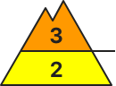
Danger level
2200m
Avalanche Problem
Persistent weak layer
2200m
Wind slab
2000m
Caution: weak layers in old snowpack
Avalanches can be triggered by persons and reach medium As snowfall intensifies, likelihood of slab avalanches above 2200m rising significantl, esp. on ridgeline W/N/E facing slopes where snow is heavy, triggerable by persons. Where snwofall is heaviest natural triggerings possible. Danger zones difficult to recognize. Isolated whump noises are warning. Caution urged in transitions from shallow to deeper snow in the regions where it is windy. Danger zones are difficult to recognize. Isolated whumpf noises can indicate imminent danger. On extremely steep S/SW/W facing slopes, increasingly frequent mostly small loose-snow avalanches are possible, esp. in afternoon in case of extended bright intervals. Pay attention to the runout zones.
Snowpack
dp.1: deep persistent weak layer
Since Wednesday 5-15 cm has been registered, locally more. Tonight more snowfall anticipated. Fresh snow and drifts lie deposited on W/N/E facing slopes above 2200m atop an unfavorable old snowpack. The old snowpack is expansively metamorphosed, with a loose surface of surface hoar and faceted crystals. Mostly small snowdrifts lie deposited on wind-protected shady slopes above 2000m atop weak layers. South-facing slopes and terrain below 2000m: atop a crust.
Tendency
Avalanche danger: no significant change expected
Danger level
1800m
Avalanche Problem
Wind slab
1800m
Snowpack
Tendency
Danger level
2000m
Avalanche Problem
Wind slab
2000m
Circumvent small-scale snowdrifts at high altitudes.
Avalanche danger is low. At high altitudes small-scale snowdrifts can be triggered in particular by large additional loading. The few avalanche prone locations occur in steep ridgeline terrain in N/E aspects. Avalanche releases are mostly small-sized, but can reach medium size in isolated cases in the Allgäu and the Berchtesgaden Alps. The new snow of the last few days can also be triggered as small loose snow avalanches in extremely steep terrain due to solar radiation. On very steep slopes with sufficient snow over smooth ground small glide-snow avalanches cannot be excluded.
Snowpack
In some places at high altitude shallow snowdrifts are still prone to triggering. Elsewhere the snow has mostly well solidified. In the Werdenfels region the snowpack surface is frequently hard in shady high altitude terrain, and only in some patches it is blanketed by a few centimeters of loose snow. In regions that saw heavy snowfall during the last few days such as Berchtesgaden or main Allgäu ridge there is powder snow on high altitude shady slopes. The old snowpack is stable, at intermediate altitude thoroughly moist and wet down to the ground.
Tendency
Barely any change of avalanche danger anticipated.
Danger level
1800m
Avalanche Problem
Wind slab
1800m
Moderate avalanche danger in high altitudes - snowdrift is prone to triggering
Avalanche danger above 1.809 m is moderate. Danger spots are located in very steep entries, gullies and behind ridgelines in the expositions north to east. There slab avalanches can be triggered by small additional loads cannot be ruled out.
Snowpack
The snow base can settle and is mostly stable. Only in high altitudes the surface is still powder-like in some places. The new snowdrift is partially placed on top of soft layers, partially on top of a hard, icy old snow cover and is not sufficiently bonding. In general the snow cover is distributed unevenly and wet in medium altitudes. Blown-off areas are often hard and icy.
Tendency
Saturday will be very cloudy with little amount of snowfall and poor visibility. The snowdrift danger will be decreasing. No significant change of the avalanche danger.
Avalanche danger above 2000m is moderate, below that altitude danger is low. Fresh snowdrift accumulations are already triggerable even by minimum additional loading, if there is sufficient snowfall medium-sized avalanches are possible. Danger zones will increase in frequency as the day progresses, occur esp. in very shady gullies and bowls distant from ridgelines on NW/N/E facing slopes. Avalanches in the old snow above 2200m are isolated, possible only in extremely steep terrain on north-facing slopes. In isolated cases small to medium sized glide-snow avalanches are possible.
Snowpack
Steep shady slopes above 2000m: up to 30 cm of fresh snow lies deposited on a metamorphosed surface. In transitions from old to fresh fallen snow and inside the snowdrift accumulations, weak layers can be generated. On sunny slopes and at lower altitudes, the bonding of fresh fallen snow to the old snowpack is generally good, weak layers are found only inside the newly generated drifts. Weak layers in the lowermost part of the snowpack are no longer likely to trigger.
Tendency
Snowdrift accumulations proneness to triggering will gradually recede
Danger level
1900m
Avalanche Problem
Persistent weak layer
1900m
Avalanche danger at high point of Danger Level 2 (Moderate)
As snowfall intensifies, likelihood of slab avalanches above 1900m rising significantl, esp. on ridgeline W/N/E facing slopes where snow is heavy. triggerable by persons. Where snowfall is heaviest natural triggerings possible. Mediium-sized releases are possible. Danger zones difficult to recognize. Isolated whump noises are warning. On extremely steep S/SW/W facing slopes, increasingly frequent mostly small loose-snow avalanches are possible, esp. in afternoon in case of extended bright intervals. Pay attention to the runout zones.
Snowpack
dp.1: deep persistent weak layer
Since Wednesday above 1400m: 20-35 cm of fresh snow, tonight another 5-15 cm is expected above 1600m. Fresh snow and drifts lie deposited on W/N/E facing slopes above 1900m atop an unfavorable old snowpack. South-facing slopes and terrain below 1900m: atop a crust.
Tendency
Due to sustained snowfall, likelihood of triggering continues to increase
Danger level
Avalanche Problem
Wind slab
During the course of the day fresh danger spots in some places.
Low avalanche danger. Nevertheless fresh snowdrift deposits in some places in shady steep areas which can be triggered by small additional loads. Danger spots are partially covered by new snow. Danger of falling is higher than the danger of being buried.
Snowpack
The snow base can settle and is mostly stable. In higher altitudes, especially north and east, thin snowdrift deposits are partially on top of soft layers, partially on top of a hard and icy old snow cover. Above that a thin powder-like new snow layer is found. In general the snow cover is distributed unevenly and wet in medium altitudes. Blown-off areas are often hard and icy.
Tendency
Saturday will be very cloudy with little amount of snowfall and poor visibility. The snowdrift danger will be decreasing. No significant change of the avalanche danger
Danger level
2000m
Avalanche Problem
Wind slab
2000m
Small danger zones due to freshly generated snowdrift accumulations
Avalanche danger is low. Fresh snowdrift accumulations are triggerable as small avalanches even from one sole skier. The few danger zones occur near ridgeline, esp. in steep shady terrain. They are often blanketed with fresh snow, making them hard to recognize. Apart from the danger of being buried in snow masses, the risks of being swept along and forced to take a fall demand adequate consideration.
Snowpack
On steep shady slopes above 2000m up to 15cm of fresh fallen snow lies deposited atop an expansively metamorphosed snowpack. In transitions from old to fresh fallen snow and inside the snowdrift masses, weak layers can form, the drifts form the slab. On sunny slopes and at lower altitudes the bonding of fresh snow to old snow is generally good, weak layers occur only inside the drifted masses. Weak layer in the lowermost part of the snowpack are no longer likely to trigger.
Tendency
Proneness of snowdrift accumulations triggering will slowly diminish.
Danger level
2000m
Avalanche Problem
Wind slab
2000m
Assess with caution freshly generated snowdrifts in steep terrain
Predominantly favorable conditions prevail, with low avalanche danger. Fresh drifts can trigger small avalanches by one sole skier. Danger zones occur esp. on shady, steep ridgeline terrain. In case of solar radiaiton, small loose-snow avalanches can trigger in extremely steep terrain.
Snowpack
Due to often brisk westerly winds, small snowdrifts accumulated which lie deposited esp. in shady steep terrain at high altitudes atop soft layers. Bonding to the old snowpack surface is poor, and deteriorates with ascending altitude. On sunny slopes and at lower altitudes, bonding to the moist old snowpack surface is generally good. The below-average snowpack is generally well consolidated. As temperatures drop, gliding snow activity has receded significantly.
Tendency
Predominantly favorable conditions
Danger level
2000m
Avalanche Problem
Persistent weak layer
2000m
Isolated danger zones occur on ridgeline NW/N/NW facing slopes
Avalanches can be triggered by persons and reach medium size, esp. by large additional loading, releases mostly small. Esp. on NW/N/NE facing ridgeline slopes above 2000m.
Snowpack
Since Wednesday 5-15 cm has been registered, locally more. Tonight more snowfall anticipated. Fresh snow and drifts lie deposited on W/N/E facing slopes above 2200m atop an unfavorable old snowpack. The old snowpack is expansively metamorphosed, with a loose surface of surface hoar and faceted crystals. Mostly small snowdrifts lie deposited on wind-protected shady slopes above 2000m atop weak layers. South-facing slopes and terrain below 2000m: atop a crust.
Tendency
Avalanche danger: no significant change expected
Danger level
treeline
Avalanche Problem
Wind slab
Treeline
Snowpack
Tendency
Danger level
treeline
Avalanche Problem
Wind slab
Treeline
Snowpack
Tendency
Danger level
2000m
Avalanche Problem
Wind slab
2000m
Favorable conditions. Caution urged towards small drifts.
Avalanche danger is low. Freshly generated snowdrift accumulations can trigger as a small avalanche. Danger zones occur at high altitudes esp. in shady, ridgeline steep terrain. Apart from the danger of being buried in snow masses, the risks of being swept along and forced to take a fall require adequate consideration. In case of solar radiation, small loose-snow avalanches can trigger in extremely steep terrain.
Snowpack
Due to often brisk westerly winds, small snowdrifts accumulated which lie deposited esp. in shady steep terrain at high altitudes atop soft layers. Bonding to the old snowpack surface is poor, and deteriorates with ascending altitude. On sunny slopes and at lower altitudes, bonding to the moist old snowpack surface is generally good. The below-average snowpack is generally well consolidated. As temperatures drop, gliding snow activity has receded significantly.
Tendency
Predominantly favorable conditions
Danger level
2000m
Avalanche Problem
Wind slab
2000m
Circumvent small-scale snowdrifts at high altitudes.
Avalanche danger is low. At high altitudes small-scale snowdrifts can be triggered in particular by large additional loading. The few avalanche prone locations occur in steep ridgeline terrain in N/E aspects. Avalanche releases are mostly small-sized, but can reach medium size in isolated cases in the Allgäu and the Berchtesgaden Alps. The new snow of the last few days can also be triggered as small loose snow avalanches in extremely steep terrain due to solar radiation. On very steep slopes with sufficient snow over smooth ground small glide-snow avalanches cannot be excluded.
Snowpack
In some places at high altitude shallow snowdrifts are still prone to triggering. Elsewhere the snow has mostly well solidified. In the Werdenfels region the snowpack surface is frequently hard in shady high altitude terrain, and only in some patches it is blanketed by a few centimeters of loose snow. In regions that saw heavy snowfall during the last few days such as Berchtesgaden or main Allgäu ridge there is powder snow on high altitude shady slopes. The old snowpack is stable, at intermediate altitude thoroughly moist and wet down to the ground.
Tendency
Barely any change of avalanche danger anticipated.