Snowdrift accumulations which are prone to triggering will be generated particularly in gullies, bowls and behind protruberances in the landscape due to fresh snow and strong to storm-velocity winds. Snowdrifts can be triggered by one single skier and are expected to remain trigger-sensitive. Avalanches can in isolated cases trigger naturally at the foot of rock cliffs and grow to medium size. They can also trigger in the weak layers in isolated cases and grow to medium size. Particularly unfavorable are shady slopes. Size and frequency of danger zones will tend to increase with ascending altitude.
Snowpack
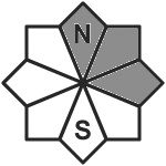
dp.6: cold, loose snow and wind dp.1: deep persistent weak layer
Up to 10 cm of fresh snow was registered regionally, locally more. The often storm-strength winds will transport the fresh and also the old snow. The varied snowdrift accumulations are often poorly bonded with each other and with the old snowpack surface, they lie particularly on NW/N/SE facing slopes above 2400m atop a weak old snowpack. The fresh drifts also lie on top of weak layers. The snowpack is highly diverse even over small areas. There is too little snow on the ground for this juncture of the season.
Tendency
Circumvent fresh snowdrifts
Danger level
2000m
Avalanche Problem
Wind slab
2000m
Small-sized snowdrifts require caution
Avalanche danger at high altitudes is moderate, danger below that altitude is low. In ridgeline terrain, in gullies and bowls, freshly generated snowdrift accumulations require high caution. They are mostly small-sized, but poorly bonded with the old snowpack and thus, prone to triggering, small - in isolated cases medium-sized - avalanches can be triggered by one sole skier. Danger of glide-snow avalanches still persists, but diminished due to lower temperatures.
Snowpack
Only a few cm of fresh snowfall, to be transported at high altitudes together with the fresh snow from Thursday. Fresh snowdrifts will accumulate. The latest batch of fresh snow lies deposited atop a well-consolidated, often melt-freeze encrusted old snowpack, following a period of lower temperatures. Only isolated small glide-snow avalanches possible.
Tendency
No significant change expected in avalanche danger levels.
Danger level
2000m
Avalanche Problem
Wind slab
2000m
Circumvent snowdrift accumulations
Avalanche danger above the timberline is MODERATE. Slabs, mostly small-sized, can be triggered even by minimum additiional loading both near to and distant from ridgelines and behind protruberances in the landscape on north, east and south facing slopes. If they fracture down to more deeply embedded layers in the snowpack the releases can grow to medium size. Isolated sm glide-snow and loose-snow avalanches can trigger naturally.
Snowpack
On top of a shallow and relatively compact snow cover, less than 30cm of snow and drifts (with embedded graupel) lie deposited. The border to the old snowpack can serve as a weak layer, more deeply embedded weak layers are triggerable only in isolated cases above 2200m.
Tendency
To begin wi, little change anticipated
Danger level
2000m
Avalanche Problem
Wind slab
2000m
Circumvent trigger-sensitive drifts
Avalanche danger above 1800m is moderate, below that altitude danger is low. Main problem: snowdrift accumulations. These can trigger a medium-sized avalanche by one sole skier/snowboarder. Avalanche prone locations occur in steep ridgeline terrain on N/E/S facing slopes and in wind-loaded gulles and bowls. At lower altitudes the slab avalanche releases are small, larger higher up. Possibility of medium-sized glide-snow avalanches on steep smooth grass-covered slopes in all aspects, releases mostly small, but occasionally medium-sized. Possibility of medium-sized glide-snow avalanches on steep smooth grass-covered slopes in all aspects, releases mostly small, but occasionally medium-sized.
Snowpack
Storm-strength westerly winds will generate often trigger-sensitive snowdrift accumulations. The old snowpack at high altitudes contains layers of faceted, rounded crystals near crusts, these are prone to triggering in isolated cases on shady slopes at 1800-2000m atop an thin icy flim, often prone to triggering. There are also trigger-sensitive layers inside the snowdrifts. The stable old snowpack fundament is frozen hard on the surface and contains several crusts inside. At intermediate altitudes it is moist-to-wet. Winds and sun-exposed zones at intermediate altitudes are often bare of snow or have only a few cm of loose snow. Also in the forest regions there is little snow on the ground.
Tendency
On Sunday, winds will shift to northeasterly. To begin with, no significant change anticipated in avalanche danger.
Avalanche danger above 2000m is MODERATE. Small-to-medium slab avalanches can be triggerd by minimum additional loading in places on north and east facing slopes, higher up also on south-facing slopes. The snowdrift accumulations are generally easy to recognize. Size and frequency of danger zones tend to increase with ascending altitude. As of 2300m, releases can fracture down to more deeply embedded layers inside the snowpack and grow to larger size. Small glide-snow and loose-snow avalanches can trigger naturally.
Snowpack
The snow cover has below average depths, is highly irregular and the layering is rather poor. With ascending altitude, increasingly frequent crusts with immediately adjacent faceted crystals are evident, mostly triggerable by large additional loading. On the surface there is less than 40cm of snowdrift, poorly bonded with the old snowpack.
Tendency
To begin with, little change anticipated
Danger level
2000m
Avalanche Problem
Wind slab
2000m
Snowdrifts prone to triggering
Fresh and older trigger-sensitive snowdrift accumulations are threatening. The accumulations can be easily triggered even by one sole skier. Danger zones occur in wind-loaded steep terrain, in gullies and bowls, and behind protruberances in the landscape. Size and frequency of danger zones tend to increase with ascending altitude. In addition, on steep shady slopes at high altitudes and in transitions from shallow to deep snow, isolated slab avalanches can be triggered by large additional loading. In zones where there has been rain impact, slides and small wet-snow avalanches are possible. Glide-snow avalanches, mostly small, continue to be possible. Caution urged below glide cracks.
Snowpack
Another 5-10 cm of fresh snow is anticipated, locally more. This and the fresh snowfall from Thursday will be transported at high altitudes. Further fresh snowdrift accumulations will be generated, which then blanket older accumulations of drifts. Fresh snow and snowdrift accumulations are not well bonded with the old snowpack and its melt-freeze crusts, often with embedded layers of graupel. Deeper layers in the old snowpack are generally compact and unlikely to trigger, mostly likely in places where the snow is shallow on very steep shady slopes.
Tendency
Fresh snowdrift accumulations remain prone to trigger at high altitudes
Danger level
treeline
Avalanche Problem
Wind slab
Treeline
Persistent weak layer
1900m
Caution: fresh snowdrift!
The avalanche danger above the tree line is moderate. Danger spots are especially fresh driftwood accumulations in the sectors north, east and south. Behind ridgelines as well as in the beginning of gullies and bowls slab avalanches can be triggered by small additional loads. In some places avalanches can slab through low weak layers within the old snow and reach medium sizes.
Snowpack
Fresh wind-drifted snow has formed in the eastern and southern sectors, which is not well bonded to the ground in places. Below this, a succession of crusts and softer layers will form an increasingly unstable snow layering in higher altitudes.
Tendency
The weather will remain cold and windy on Monday. The avalanche danger doesn’t change significantly.
Danger level
treeline
Avalanche Problem
Wind slab
Treeline
Persistent weak layer
Treeline
Snowpack
Tendency
Danger level
1800m
Avalanche Problem
Wind slab
1800m
Caution: fresh snowdrift accumulations.
Snowdrift accumulations which are prone to triggering have been generated particularly in gullies, bowls and behind protruberances in the landscape due to fresh snow and strong-velocity winds will increase further The freshly generated drifts can be triggered even by one sole skier. Isolated dry-snow avalanches also possible, esp. in the major areas of participation. Releases will be mostly small-sized, medium-sized in isolated cases. Size of danger zones tend to increase with ascending altitude.Shady slopes are especially unfavorable. Danger zones tend to increase in frequency with ascending altitude.
Snowpack
dp.6: cold, loose snow and wind
Some snowfall ws registered regionally, which stormy winds will transport, including the old snow. The varied drifts are often poorly bonded with each other and with the snowpack. Drifts lie atop a weak old snowpack above 1800m on shady slopes. The snowpack is highly varied over small areas. There is too little snow on the ground for this juncture of the season.
Tendency
Caution: fresh snowdrifts
Danger level
treeline
Avalanche Problem
Wind slab
Treeline
Snowpack
Tendency
Danger level
Avalanche Problem
Wind slab
Low avalanche danger, little snow on the ground
Avalanche danger is low. Main problem: freshly generated snowdrift accumulations which in wind-loaded zones on N/E/S facing slopes can trigger by minimum additional loading. Slab avalanche releases are small, the risks of taking a fall are greater.
Snowpack
Since Thursday night, storm-strength westerly winds have often been generating trigger-sensitive snowdrift accumulations. The old snowpack at high altitudes is often frozen hard, it is generally stable and moist-to-wet. The old snowpack fundament is frozen hard on the surface and contains several crusts inside. At intermediate altitudes, sunny slopes are often bare of snow or have only a few cm of loose snow. Also in the forest regions there is little snow on the ground.
Tendency
On Sunday, winds will shift to northeasterly. No significant avalanche danger anticipated
Danger level
Little snow on the ground. Only isolated avalanche-prone locations.
Avalanches are hardly possible. Isolated danger zones occur on shady slopes and in gullies and bowls.
Snowpack
There was some regional snowfall. The storm-strength winds will transport the fresh snow, also some of the old snow. Mostly shallow snowdrift accumulations occur from place to place. These accumulations of drifts lie deposited on shady slopes above 1800m atop a rather shallow old snowpack surface. The old snowpack is expansively metamorphosed.
Tendency
No change expected in avalanche danger levels
Danger level
treeline
Avalanche Problem
Wind slab
Treeline
Low avalanche danger - only isolated danger spots due to fresh snowdrift deposits.
The avalanche danger is low. Danger spots are fresh snowdrift deposits in some places. These are located in high entrances to gullies and bowls and behind terrain edges, especially in eastern and southern exposures. Small slab avalanches can be triggered here by even a low additional load.
Snowpack
In the extended eastern sector small fresh snowdrift deposits are formed in some places. At shady high altitudes and in blown-in gullies, a small unstable snow base in form of a succession of crusts and softer layers is present. At medium and lower altitudes as well as on sunny slopes, the snow base is missing.
Tendency
The weather on Monday will be cold and windy. The avalanche danger doesn’t change significantly.
Danger level
Avalanche Problem
Wind slab
Circumvent snowdrift accumulations
Avalanche danger above the timberline is MODERATE. Slabs, mostly small-sized, can trigger particularly on very steep and extremely steep north, east and south-facing slopes by minimum additional loading. Isolated small glide-snow and loose-snow avalanches can trigger naturally.
Snowpack
On top of a shallow and relatively compact snow cover, less than 30cm of snow and drifts (with embedded graupel) lie deposited. The border to the old snowpack can serve as a weak layer, more deeply embedded layers are unlikely to trigger.