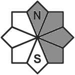
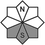
Slab avalanches in the snowdrifts can fracture down to deeper weak snowpack layers
Avalanche danger above the treeline is considerable, below that altitude danger is low. Snowdrift accumulations are the main problem. Slab avalanches of medium size can in some places b e triggered even by minimum additional loading, i.e. the weight of one person. In some places they can fracture down to deeper weak layers in the old snow and therebe grow to large size. Danger zones can be difficult to recognize due to diffuse light conditions. They occur also distant from ridgelines and on slopes in all aspects. Caution required at the edges of forest zobnes. In transitions from shallow to deep snow, slab avalanches in the old snow can be triggered by one single person.
Snowpack
The fresh fallen snow is being heftily transported. Inside the fresh snow, short-lived weak layers are forming near the surface. At high altitudes the fresh snow is falling atop a generatlly wind-compressed snowpack surface where the bonding is good. In wind-protected zones the old snowpack surface can be loosely packed and thus, constitute a weak layer. Deeper down inside the old snowpack fundament there are soft layers lodged between hard layers at high altitudes. At low and intermediate altitudes the old snowpack beneath the fresh fallen snow is melt-freeze encrusted. The snow base evidences no marked weak layers. However, the entire snowpack can start to glide over steep rock plates or grassy slopes.
Tendency
Snowdrift accumulations remain prone to triggering.
Danger level
treeline
Avalanche Problem
Wind slab
Treeline
Persistent weak layer
2200m
Fresh snowdrifts are the main danger
Avalanche danger above the treeline is considerable, below that altitude danger is low. Snowdrift accumulations above the treeline can be easily triggered even by one single winter sports enthusiast and grow to medium size. Slab avalanches can often fracture down to more deeply embedded layers inside the snowpack and grow to large size. Danger zones occur particularly behind protruberances in the landscape, in gullies and blows and on wind-loaded slopes. These have been covered by fresh snow in many places, making them difficult to recognize. Whumpf noises and glide-cracks when the snowpack is stepped on are signals of danger. At low and intermediate altitudes on steep grass-covered slopes, small glide-snow avalanches are possible.
Snowpack
Since yesterday there has been 40-45cm of fresh snow registered in the barrier cloud regions, elsewhere 25-30cm. Due to strong-to-storm strength W/NW winds there has been wide-reaching transport. During the daytime due to brisk-to-strong NW winds, and tomorrow W/SW winds, additional trigger-sensitive snowdrift accumulations have been generated and will continue to be. The drifts lie deposited atop a weak old snowpack on high-altitude shady slopes, on sunny slopes often atop a thin melt-freeze crust. Weak layers can occur on high altitude slopes where the old snowpack was previously loose and also inside the snowdrifts themselves. During the daytime, in addition, graupel showers will pass through. At low altitudes the fresh snow and drifts lie deposited atop a moistened old snowpack surface with better consolidation.
Tendency
Following a brief improvement in weather conditions on Saturday, renewed preciptiation will set in during Saturday night, accompanied by strong-to-storm strength W/NW winds. Avalanche danger levels are expected to increase significantly over widespread areass.
Due to fresh snowfall and increasily stormy winds, far-reaching snowdrift accumulations are being generated, particularly at the foot of rock cliffs and behind protruberances in the landscape. These can be easily triggered in all aspects above 2200m or else trigger naturally. In addition, avalanches can fracture down to more deeply embedded layers inside the snowpack, especially along the Salzburg border where medium-sized releases are possible. Whumpf noises and glide-cracks when you tread upon the surface can be indicators of immediate danger. Frequency and sizes of danger zones tend to increase with ascending altitude.
Snowpack
dp.6: cold, loose snow and wind dp.4: cold following warm / warm following cold
Up to 20 cm of snowfall is expected from place to place. The widespread snowdrift accumulations on shady wind-protected slopes above 2200m are being deposited atop a weak old snowpack surface. At mid-level inside the old snowpack on shady, wind-protected slopes there are faceted, expansively metamorphosed weak layers evident. The snowpack is highly irregular even over small areas.
Tendency
Evaluate snowdrift accumulations with great caution
Danger level
treeline
Avalanche Problem
Wind slab
Treeline
New snow
Avoid fresh snowdrifts.
Avalanche danger above the treeline is moderate, below that altitude danger is low. Fresh snowdrifts are the main problem. Snowdrifts can be triggered as medium-sized slab avalanches even by minimum additional loading. Avalanche prone locations are found in steep ridgeline terrain in N/E/S aspects and in wind-loaded gullies and bowls. At high altitudes, avalanches can fracture down to weak layers embedded in the old snow. Small glide snow avalanches still possible on steep smooth grass-covered slopes.
Snowpack
Stormy northwesterly winds will transport 10 cm to 20 cm of new fallen snow; in orographic barrier zones in Allgäu up to 30 cm of new fallen snow. When precipitations cease the wind will abate. Therefore, the snowdrifts are partly loosely blanketed and difficult to detect. At intermediate altitudes these are deposited on bare ground, in particular in south aspects, or on a moist old snow surface with which they will bond well. Weak layers are here mainly found embedded in the snowdrifts. Whereas in particular at high altitudes, these are often deposited atop a thin melt-freeze crust, under which a layer consisting of faceted crystals has formed which is prone to triggering. More deeply embedded in the snowpack there are also weak, expansively metamorphosed layers close to crusts. At intermediate altitudes the snowpack is wet down to the ground.
Tendency
Slight decrease of avalanche danger by Saturday. Slight decrease of avalanche danger by Saturday.
Danger level
1800m
Avalanche Problem
Wind slab
1800m
Evaluate snowdrift accumulations on shady slopes with great caution
Due to fresh snowfall and increasily stormy winds, far-reaching snowdrift accumulations are being generated, particularly on shady slopes above 1800m: easily triggered or triggering naturally. Gullies and bowls are unfavorable, since weak layers are evident inside the old snow. Avalanches are mostly small-sized. Apart from the risk of being buried in snow masses, you also need to take the dangers of being swept along and forced to take a fall into consideration.
Snowpack
dp.1: deep persistent weak layer
Especially along the Italian border, up to 25cm of fresh snow is anticipated, locally more. The snowdrift accumulations blanket a weak old snowpack on shady slopes above 1800m. The old snowpack is faceted and highly irregular over small areas.
Tendency
Avalanche danger levels are not expected to change significantly.
Danger level
1600m
Avalanche Problem
Wind slab
1600m
Snowpack
Tendency
Danger level
1800m
Avalanche Problem
Wind slab
1800m
Snowpack
Tendency
Danger level
1800m
Avalanche Problem
Wind slab
1800m
Fresh snowdrift!
Moderate avalanche danger above 1.800 m. Wind slab problem! The danger spots are located in the sectors north to southeast. In the beginning of gullies and bowls an individual person can trigger a slab avalanche which can have a size of 1 to 2.
Snowpack
About 30 cm new snow has fallen during low temperatures in the last 24 hours. Due to strong winds it has drifted to the sectors east and north. Potential weak layers within the snowdrift layer on the edge to the old snow are possible.
Tendency
Slab avalanche danger in high altitudes doesn´t change.
Danger level
treeline
Avalanche Problem
Wind slab
Treeline
New snow
Avoid fresh snowdrifts.
Avalanche danger above the treeline is moderate, below that altitude danger is low. Fresh snowdrifts are the main problem. Snowdrifts can be triggered as medium-sized slab avalanches even by minimum additional loading. Avalanche prone locations are found in steep ridgeline terrain in N/E/S aspects and in wind-loaded gullies and bowls. At high altitudes, avalanches can fracture down to weak layers embedded in the old snow. Small glide snow avalanches still possible on steep smooth grass-covered slopes.
Snowpack
Stormy northwesterly winds will transport 10 cm to 20 cm of new fallen snow; in orographic barrier zones in Allgäu up to 30 cm of new fallen snow. When precipitations cease the wind will abate. Therefore, the snowdrifts are partly loosely blanketed and difficult to detect. At intermediate altitudes these are deposited on bare ground, in particular in south aspects, or on a moist old snow surface with which they will bond well. Weak layers are here mainly found embedded in the snowdrifts. Whereas in particular at high altitudes, these are often deposited atop a thin melt-freeze crust, under which a layer consisting of faceted crystals has formed which is prone to triggering. More deeply embedded in the snowpack there are also weak, expansively metamorphosed layers close to crusts. At intermediate altitudes the snowpack is wet down to the ground.
Avalanche danger above the treeline is moderate, below that altitude danger is low. Snowdrift accumulations above the treeline can be triggered by one single skier and in isolated cases grow to medium size. Danger zones occur especially behind protruberances in the landscape, in gullies and bowls, and on wind-loaded slopes. Size and frequency of these avalanche prone locations tend to increase with ascending altitude. They have been blanketed in some places, making them difficult to recognize. Below the treeline avalanche danger is low. At low altitudes small glide-snow avalanches are possible on steep grass-covered slopes.
Snowpack
Since yesterday there has been 25-30cm of fresh now registered. Due to strong-to-storm strength W/NW winds there has been wide-reaching transport. During the daytime due to brisk-to-strong NW winds, and tomorrow W/SW winds, additional trigger-sensitive snowdrift accumulations have been generated and will continue to be. The drifts lie deposited atop a weak old snowpack on high-altitude shady slopes, on sunny slopes often atop a thin melt-freeze crust. Weak layers can occur on high altitude slopes where the old snowpack was previously loose and also inside the snowdrifts themselves. During the daytime, in addition, graupel showers will pass through. At low altitudes the fresh snow and drifts lie deposited atop a moistened old snowpack surface with better consolidation.
Tendency
Following a brief improvement in weather conditions on Saturday, renewed precipitation will set in during Saturday night, accompanied by strong-to-storm strength W/NW winds. Avalanche danger levels are expected to increase significantly over widespread areass.
Avalanche danger levels above the treeline are moderate, below that altitude danger is low. Snowdrifts are the major problem. Slab. avalanches of medium size can be triggered even by minimum additional loading, particularly near to ridgelines on N/E/SW facing slopes. Danger zones are difficult to recognize due to diffuse light conditions.
Snowpack
The fresh snow is being transported far-reachingly. Inside the fresh snow, short-lived weak layers are forming near the surface. At high altitudes the fresh snow is falling atop a generatlly wind-compressed snowpack surface where the bonding is good. In wind-protected zones the old snowpack surface can be loosely packed and thus, constitute a weak layer. Deeper down inside the old snowpack fundament there are soft layers lodged between hard layers at high altitudes. At low and intermediate altitudes the old snowpack beneath the fresh fallen snow is melt-freeze encrusted. The snow base evidences no marked weak layers. However, the entire snowpack can start to glide over steep rock plates or grassy slopes.
Tendency
Snowdrift accumulations will remain prone to triggering
Danger level
Avalanche Problem
No distinct avalanche problem
Snowpack
Tendency
Danger level
Avalanche Problem
Wind slab
New snow and snowdrift in high altitudes!
Low avalanche danger. A little more danger spots formed due to snowdrift. These are located in gullies and bowls above 1.800 m mainly in the sector east. Slab avalanches can be triggered by high additional loads.
Snowpack
In the last 24 hours it had 10 - 20 cm new snow. The biggest amount was in the area of Hochschwab. In Niedere Tauern and Turrach it had around 10 cm. The new snow landed on surface hoar - on the sunny side on grass. The snow base is thin and shows no significant weak layers.